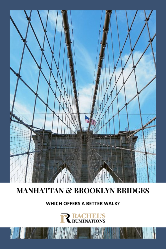
Walking across the Manhattan Bridge & the Brooklyn Bridge

A classic and very popular thing to do in New York City is to walk across the Brooklyn Bridge. Did you know, though, that you can also walk across the Manhattan Bridge?
When I was in New York recently, intent on keeping to a tight budget, I checked my own post about budget things to do in New York City, and decided to take a walk across both bridges.
Disclosure: This article contains affiliate links. If you click on one and make a purchase, I will receive a small commission. This will not affect your price.
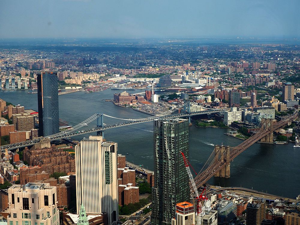
The bridges are right next to each other, relatively speaking. Both are suspension bridges over the East River and connect Manhattan to Brooklyn. They both have walking and bicycling paths. The distance between Brooklyn and Manhattan is about 2 km where both bridges are. But that’s where the similarities end.
Tip: Learn about the Brooklyn Bridge and Dumbo on a small-group tour.
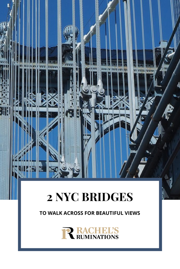
The Manhattan Bridge
It was a Saturday morning, and I started on the Manhattan Bridge, headed for Brooklyn.
According to Wikipedia, the Manhattan Bridge was completed in 1909, originally with only one level, designed by Leon Moisseiff. It held car traffic in both directions as well as trolley tracks, soon replaced by subway tracks. In 1922, the upper level was added.
Today, both levels accommodate traffic, while only the lower level carries subway tracks. In the early 2000s two more paths were added: one pedestrian walkway and one bicycle path. The bridge has needed lots of repair over the last 100 years, mostly due to the wear and tear of the subway trains rattling across it.
You might also be interested in these articles:
Following the walking route from Chinatown that Google maps presented to me, I ended up on the southwest side of the bridge. It turns out that the southwest side is reserved solely for pedestrian traffic, while bicycles are relegated to the northeast side only.
Walking across the Manhattan Bridge
Before even entering the bridge’s pedestrian path, I stopped briefly at the Mahayana Temple Buddhist Association, a moment of peace in the frenzy of Lower Manhattan. You’ll find it on the left as you face the bridge, before the big Bridge Arch and Colonnade that spans the entrance to the bridge.

Walking across the Manhattan Bridge was a pleasant experience on a Saturday morning, except when subway trains passed. The video below gives you an idea of how loud they are. What it can’t show is that the whole structure shakes when they pass.
It made me a bit nervous at first, but I got used to it. When a subway car was not passing, the noise subsided considerably to the usual dull roar of New York City and the whoosh of the cars zipping by to my left and on the upper roadway.
I had the path practically to myself, only encountering an occasional jogger or walker, as you can see in the last frames of the video. This bridge seems to be off the tourist radar.

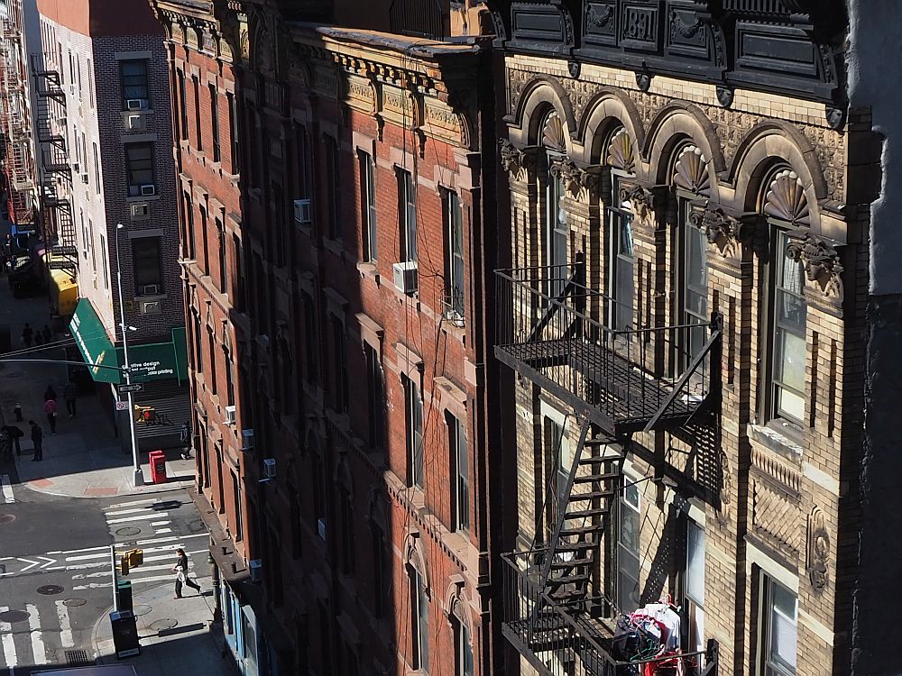
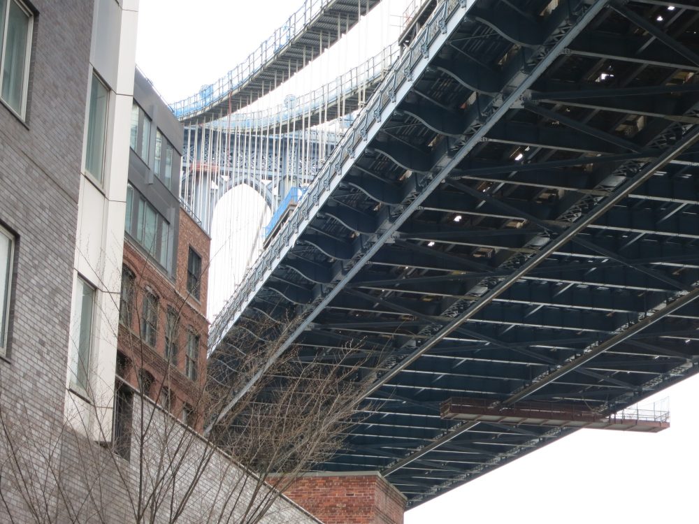
The first part of the bridge is sloped upwards, of course, and rises above the city streets of Chinatown. It gives an unusual view, so that architectural elements you’d normally have trouble seeing are much nearer by.
Even on the main span at the middle of the bridge, you can’t get a view of the whole city. The path is on the south side of the bridge so you only get lower Manhattan’s cluster of skyscrapers, including the new World Trade Center. The midtown skyscrapers aren’t visible because the bridge’s structure blocks the view.

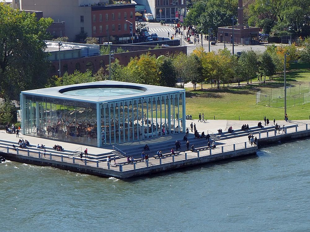
At the same time, you have a great view of the Brooklyn Bridge and also of Brooklyn. As you near the other side, you can look down at the newish public spaces edging Brooklyn: Main Street Park, Empire Fulton Ferry Park, and the little glass building holding Jane’s Carousel.
A short time in Brooklyn
The Manhattan Bridge is over two kilometers long (1.3 miles) and I’d walked quite a bit just to get to it. At this point it was lunchtime so that became my goal: to find a place to have lunch somewhere on the route between the Manhattan Bridge and the Brooklyn Bridge.
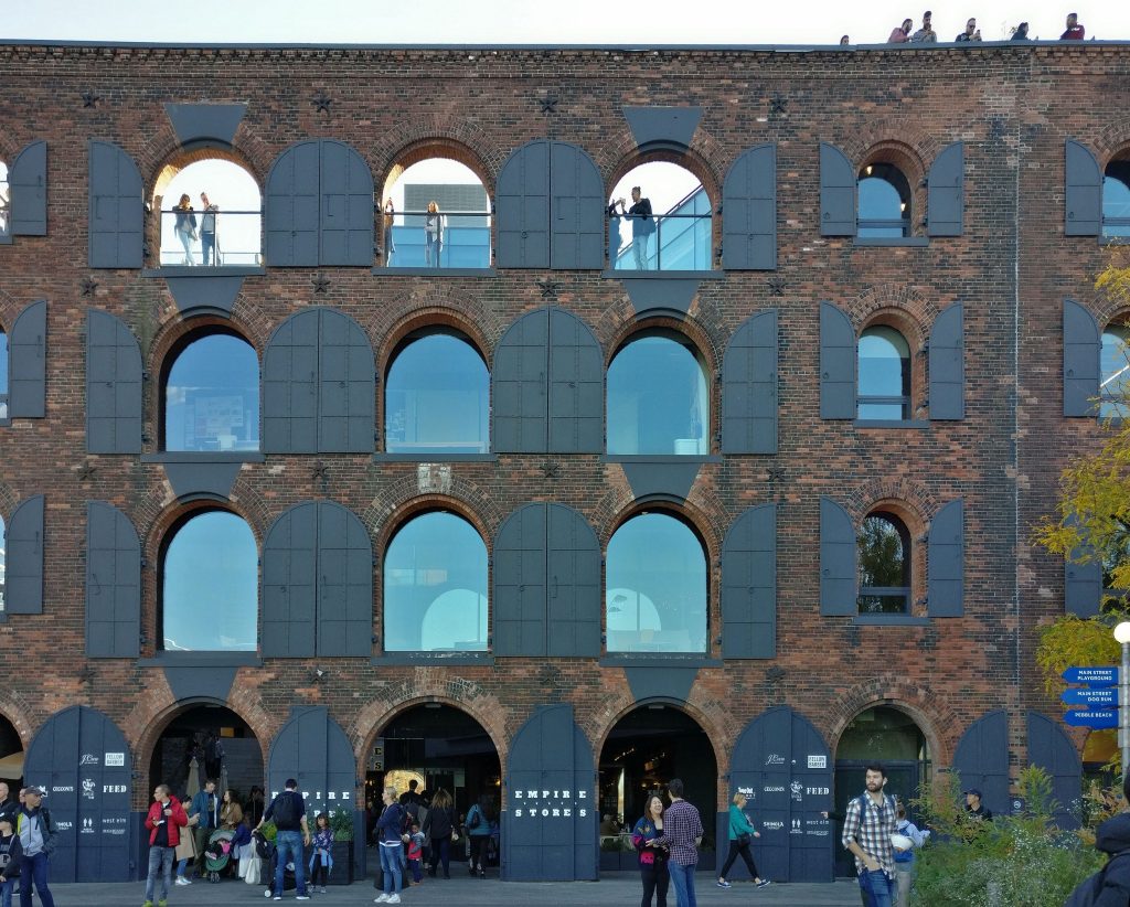
I ended up at the area generally referred to as DUMBO, which does not stand for the elephant but rather for “Down Under Manhattan Bridge Overpass.” Once a thriving waterfront district for shipping (tobacco, coffee, sugar, leather and lots of other products) and fishing, the old brick warehouses and factories remain, now converted for other uses: offices, shops and housing.
Inside one of the buildings is a high-end mall called Empire Stores, including the Time Out Market, a food court of sorts, but very chic and rather expensive.
Before choosing food, though, I stopped into the Center for Brooklyn History‘s exhibition called “Waterfront” in the same building. The exhibit there focuses solely on this section of Brooklyn: the businesses in these warehouses, the goods that were imported through here, and the people who came here to work. It is small but interesting, and I’m sure a trip to the main location of the Brooklyn Historical Society on Pierrepont Street would be well worth the time, but I didn’t find that time.
After the museum, I spent quite a while wandering the extremely crowded and loud food hall on the first floor, trying to decide what I wanted for lunch from all the tempting choices. (There are also some food choices up on the fifth floor.) I eventually decided on a bowl of soup from Mr. Taka Ramen. It took a while to get my soup because of the line to order and then the wait while it was prepared. Then I had trouble finding a seat at any of the communal tables – remember, this was a good weather Saturday at lunchtime.
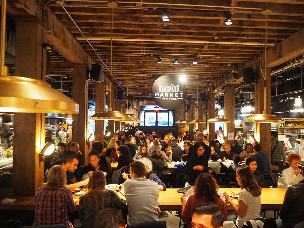
After I finished eating, I first spent at least a half an hour in the ridiculously long line for the ladies’ room. Then I took a quick look upstairs on the 5th floor. It was just as crowded, but up there you can get a great view of both bridges. I’d recommend going up there just for the view, even if you don’t want to get any food or shop.
And, by the way, much of the waterfront here is very strollable, with riverfront walking paths in strips of parkland.
The Brooklyn Bridge
The Brooklyn Bridge turned out to be a very different experience from the Manhattan Bridge.
The Brooklyn Bridge is older than the Manhattan Bridge. Designed by John Roebling, his son, Washington Roebling, completed it as chief engineer, according to Wikipedia, although he was ill for a large part of the building process. He probably suffered from decompression sickness from working below the river level in the caissons of the bridge, breathing compressed air. Decompression sickness was often referred to as caisson disease at the time. His wife, Emily Roebling, took over much of the day-to-day work.
The bridge was completed in 1883 and was the first steel-wire suspension bridge in the world. Smaller than the Manhattan Bridge and a bit shorter at 1.8 kilometers (1.1 mile), its support towers are made of stone blocks.

Like the Manhattan Bridge, the Brooklyn Bridge has two levels. Originally carrying horse-drawn carriages, railway lines, and later, trolley tracks, nowadays it holds car traffic (no trucks allowed) on the main level and pedestrians and bicyclists above the car lanes. It has also been upgraded and repaired a number of times over the last 100+ years.
My walk across the Brooklyn Bridge
While the pedestrian and bicycle lanes are well-separated from the car lanes, since they’re a level higher up, they’re not well-separated from each other. Essentially, it is one path, about three to five meters wide, with a line painted down the middle. Foot and bicycle traffic in both directions share this one pathway.
At the same time, walking and biking across the Brooklyn Bridge are very popular things to do, both among New Yorkers and tourists, especially on a sunny October Saturday like the day I decided to do it.

It was extremely crowded. I couldn’t really stroll, as I had on the other bridge. Rather, I stepped and stopped and cut to the left or right around selfie-takers or just shuffled along behind whoever was in front of me. Tourists stopped short to take pictures. Some sat on the side walls to pose for selfies. Many paid no attention to the line slicing down the center of the roadway and sidled along, oblivious to oncoming bicycle traffic. And bicyclists – less likely to be tourists and more likely to be locals trying to get from point A to point B – got very annoyed, yelling and whistling and ringing bells to try to get walkers off their path.
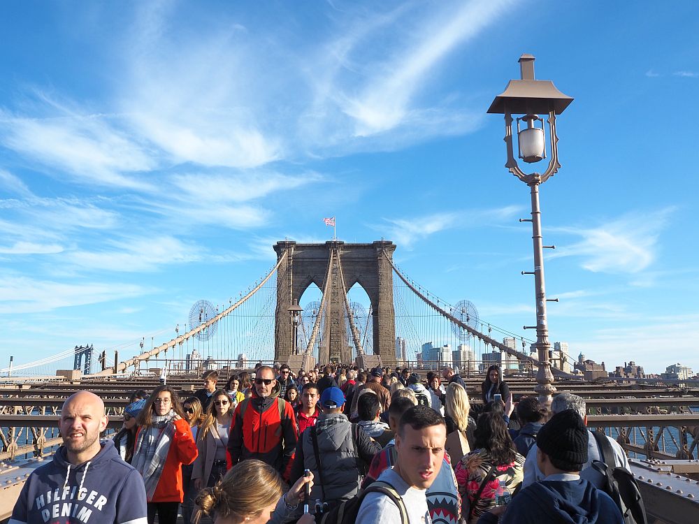
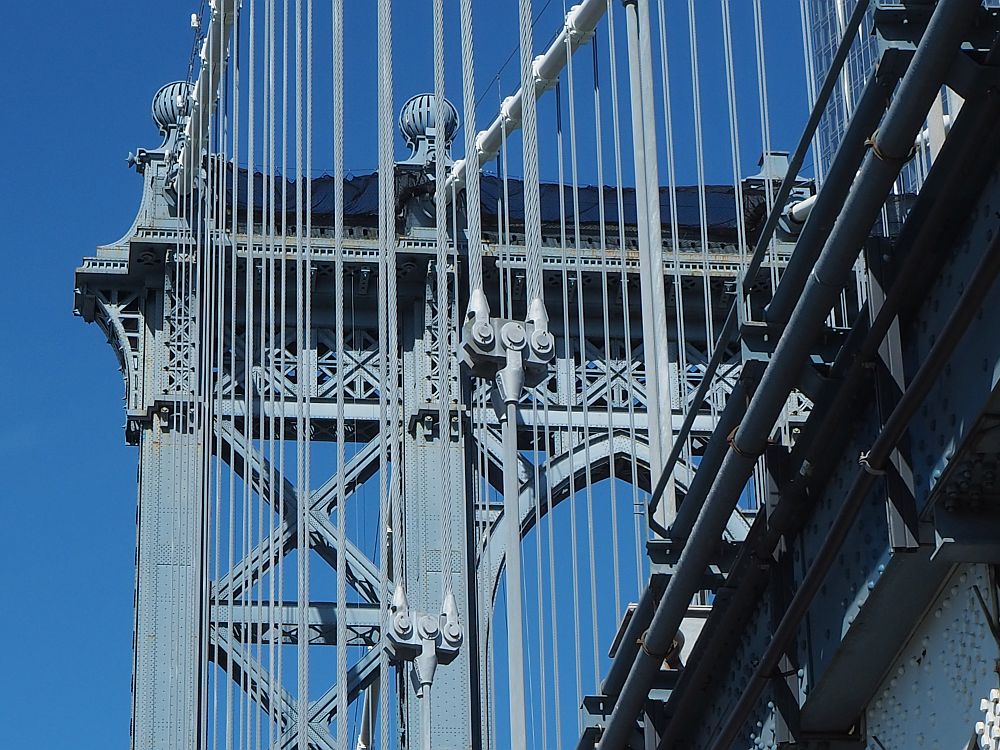
It was much less fun for me than the Manhattan Bridge. The views weren’t as good either, since the pedestrian/bicycle path runs down the center of the bridge rather than on one edge or another. Any views I got were crossed by the bridge’s cables or the steel structure of the roadways below, as you can see in the photo above.
On the other hand, the bridge itself is prettier, with its stone-built Gothic Revival arches. It also allows views from both sides, even if they are partly obstructed. From here I could see both the southern Manhattan skycrapers and the skyscrapers of midtown, including the Art Deco Chrysler Building and the Empire State Building.

Which bridge should you cross?
- If you have the time to walk both bridges, you should. Time it so that you cross the Brooklyn Bridge earlier in the day. It would have been better on a sunny Saturday if I’d started with the Brooklyn Bridge and then done the Manhattan Bridge.
- If you don’t have the time to do both, and you can choose a less popular time – a weekday early morning, for example – I’d suggest the Brooklyn Bridge. It is prettier and has bigger views.
- If you can’t do both and you only have, for example, a Saturday or Sunday afternoon, stay away from the Brooklyn Bridge. Enjoy the relative peace of the Manhattan Bridge and save the other for another time.
- You could also take a bike tour of the Brooklyn Bridge, but make sure it’s not at a peak time! Same goes for any walking tour of the bridge.
- Both of the bridges appear to have wheelchair access. However, I’d highly recommend the Manhattan Bridge over the Brooklyn Bridge for wheelchair users. A wheelchair could fit on the Brooklyn Bridge, but even at less busy times you’ll have people posing for selfies, for example, completely unaware that they’re blocking the path. Then add the bicycles trying to get by, and it’s a mess. If pedestrians have to step aside for your wheelchair and aren’t paying attention, they could get hit by the bicycles. Be aware that both bridges’ pedestrian walkways have a significant slope at either end.
- If you’re choosing just one of the bridges, look at where they end up. The Manhattan Bridge has one end right in Chinatown, while the Brooklyn Bridge puts you closer to the Financial district. On the other side, the Brooklyn Bridge will bring you closer to Brooklyn Heights and Brooklyn Bridge Park, while the Manhattan Bridge ends in the DUMBO neighborhood nearby downtown Brooklyn.
- If these things matter to you, the Brooklyn Bridge is a National Historic Landmark, and both bridges are National Historic Civil Engineering Landmarks.

By the way, there is another bridge over the East River, but a bit further north: the Williamsburg Bridge, which connects the Lower East Side of Manhattan to the Williamsburg section of Brooklyn. I haven’t done that walk, and I’ve heard the views are somewhat less awe-inspiring.
Some other advice
- There is no food or drink available on either bridge, except for the occasional person at one end or the other selling overpriced sodas out of a cooler. Bring water if it’s a hot day.
- If it’s not a hot day, bring layers. The wind really picks up once you’re on either bridge.
- Wear good walking shoes. The bridges are long, and you should also factor in any additional walking to and from subway stations before and after.
- On the Brooklyn Bridge, watch out for bicycles! Stay in the pedestrian lane.
- When you stop to take pictures, be aware of what’s going on around you.
- I saw some people sitting up on the wall on the Brooklyn Bridge to get a better view or a better selfie. Don’t do this. If you lose your balance or some oblivious selfie-taker bumps into you, you could end up hitting the pavement of the traffic lanes below.
- Both bridges are free to cross. If you’re on a tight budget, pack snacks or lunch for yourself.
Zoom in on the map below to find accommodations in New York City:
Getting there
Nearest subway stations to the Manhattan Bridge
On the Manhattan side, Grand Street (B and D trains), East Broadway (F train), and Canal Street (4, 6, J, Z, N, Q, R, W) stations are all a few blocks from the entrance to the bridge.
On the Brooklyn side, York Street station (the F train) is closest to where you descend from the path. I didn’t plan my route from there to the Brooklyn Bridge. I could see which general direction I needed to walk and just did that.
Nearest subway stations to the Brooklyn Bridge
On the Manhattan side, the Brooklyn Bridge-City Hall station (4, 5 and 6 trains) is closest. Chambers Street (J and Z trains) is only a bit further.
On the Brooklyn side, the High Street-Brooklyn Bridge station (A and C trains) is closest.
Have you ever walked across either bridge? What was your experience?
My travel recommendations
Planning travel
- Skyscanner is where I always start my flight searches.
- Booking.com is the company I use most for finding accommodations. If you prefer, Expedia offers more or less the same.
- Discover Cars offers an easy way to compare prices from all of the major car-rental companies in one place.
- Use Viator or GetYourGuide to find walking tours, day tours, airport pickups, city cards, tickets and whatever else you need at your destination.
- Bookmundi is great when you’re looking for a longer tour of a few days to a few weeks, private or with a group, pretty much anywhere in the world. Lots of different tour companies list their tours here, so you can comparison shop.
- GetTransfer is the place to book your airport-to-hotel transfers (and vice-versa). It’s so reassuring to have this all set up and paid for ahead of time, rather than having to make decisions after a long, tiring flight!
- Buy a GoCity Pass when you’re planning to do a lot of sightseeing on a city trip. It can save you a lot on admissions to museums and other attractions in big cities like New York and Amsterdam.
- Ferryhopper is a convenient way to book ferries ahead of time. They cover ferry bookings in 33 different countries at last count.
- I’ve become an affiliate for VisitorsCoverage travel insurance, mostly because you should ALWAYS have travel insurance when you travel! You may be young and healthy and never get sick, but the fact is, sh*t happens, and it’s worse if you don’t have insurance!
Other travel-related items
- It’s really awkward to have to rely on WIFI when you travel overseas. I’ve tried several e-sim cards, and GigSky’s e-sim was the one that was easiest to activate and use. You buy it through their app and activate it when you need it. Use the code RACHEL10 to get a 10% discount!
- Another option I just recently tried for the first time is a portable wifi modem by WifiCandy. It supports up to 8 devices and you just carry it along in your pocket or bag! If you’re traveling with a family or group, it might end up cheaper to use than an e-sim. Use the code RACHELSRUMINATIONS for a 10% discount.
- I’m a fan of SCOTTeVEST’s jackets and vests because when I wear one, I don’t have to carry a handbag. I feel like all my stuff is safer when I travel because it’s in inside pockets close to my body.
Rachel Heller is a writer living in Groningen, the Netherlands. She is the owner and primary author of this website, Rachel’s Ruminations, a travel blog focused on independent travel with an emphasis on cultural and historical sites/sights. Read more here about her and about this website. All photos in her articles are her own, unless otherwise specified. Rachel also owns and operates a website about World Heritage travel.
Nice of you to think of this. Absolutely a great way to spend a day and be part of your fitness regimen. Love the views and the details.
Thanks, Carol. And other than lunch and the subway, the whole day was free of charge!
It’s been so many decades now since my last visit to New York. It was just a hop, skip and jump away from Boston. This post reminds me that it would be nice to revisit. Thanks for the tips. Never walked the bridge before but found driving on the Brooklyn Bridge gave me palpitations :-).
Oh, I wouldn’t want to drive there! And parking is outrageously expensive. I prefer the subway: great people-watching. I lived in NYC for a year and a half back in the 80s, but I was on such a tight budget that I lived in a horrible little room and only took the subway when the weather was truly terrible. So I missed out on all the things a person can enjoy in the city, often for free or cheap. This recent trip was an absolute joy!
What a fun experience and tour, thanks for sharing that experience – now I want to do the same walking experience.
Choose a weekday outside of a vacation and enjoy!
We never realized that there was so much foot traffic on the Manhattan and Brooklyn Bridges. I guess we are the only ones who haven’t visited these two historic structures. Perhaps we need to plan on remedying this oversight.
There’s far more foot traffic on the Brooklyn Bridge than the Manhattan Bridge. It’s definitely a great urban walk, if that’s what you’re looking for.
I LOVE NY! Duh! I also LOVE your images–very nice. And I LOVE the Brooklyn Bridge. When I walked across it, there were nutty people there at the same time–standing/hanging out there on cables over the water in high heels! I’ll never forget that!
Scary! And stupid! When I was there they were just sitting on the wall over the roadway. It made me nervous anyway because the walkway was so crowded, especially when a bicyclist was trying to pass. They could easily get pushed and lose their balance!
Walking across the Manhattan Bridge looks like a good way of getting a different perspective on the city, and seeing places you might otherwise miss.
No toilets either. Plan a”head”….
Good point! There are toilets in the Empire Stores, though it was so busy when I was there that the wait (at least for the women’s toilet) was really long.
I strongly agree with your observations. The Manhattan Bridge was nearly empty when I walked across it on a Monday morning. The Brooklyn Bridge was comparatively crowded a few hours later (although still much less so than pre-pandemic). Despite the Manhattan Bridge walkway’s close proximity to traffic and the very loud subway tracks, I still found it more relaxing than the Brooklyn Bridge’s selfie photographers, big families stopping in the pedestrian lane, and others obliviously walking in the bike lane.
My friend and I walked the Brooklyn Bridge at night and the view was beautiful with all the buildings lit up! Also there were almost no other people. I felt very safe. It was peaceful and quiet.
Great tip! I didn’t get to see it at night!