Things to do in Heimaey island, Vestmannaeyjar, Iceland
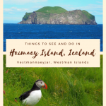
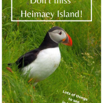
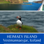
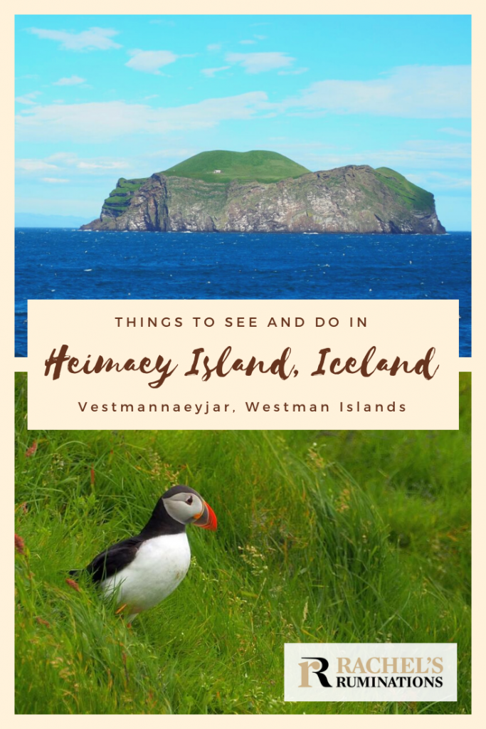
Puffins. That’s why we decided to visit Heimaey island in the Westman Islands, Iceland. Heimaey is home to one of the largest puffin colonies in the world. We had to see that.
It turned out, though, that there were other things to see and do in Heimaey as well.
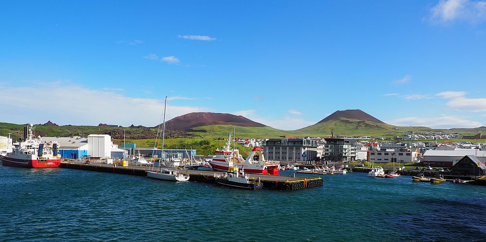
Heimaey Island is part of Vestmannaeyjar, also known as the Westman Islands, an archipelago of small islands south of Iceland. Only Heimaey Island has year-round inhabitants; it is a charming small island with about 4100 inhabitants.
Disclosure: This post contains affiliate links. If you click on one and make a purchase, I will receive a small percentage of what you spend. This will not affect your price.
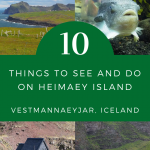
Below is a list of things to see and do on Heimaey Island. We did almost all of them in one very full day in July, when the days in Iceland are very long. If you stayed for two or three nights you’d have room for more, especially in terms of walking or hiking.
The list is in no particular order of importance. Instead, it’s the order in which we saw things in one evening and one full day. I’ve added a few more items at the end of the list that we didn’t get to do. There’s a map as well, with every item from this article marked on it. You can use the table of contents below to jump around.
Eldheimar Volcanic Museum
Heimaey has a very dramatic recent history. In 1973, a huge volcanic eruption on the island ripped a big crack through the main town and then proceeded to spew lava and ash for months. The resulting Eldfell volcano is 226 meters high. You can walk a path up to its summit for the view of the new black lava fields.
Everyone on the island – more than 5000 people at the time – evacuated, apart from a few who stayed to try to slow down the lava flow to save some of the town. The townspeople were extraordinarily lucky that their local fishing boats just happened to have stayed in port that day due to bad weather.
By the time the lava stopped flowing months later, the island had grown by about 20 percent and about half the houses had been destroyed. Many of the rest had been damaged. Only one person was killed.
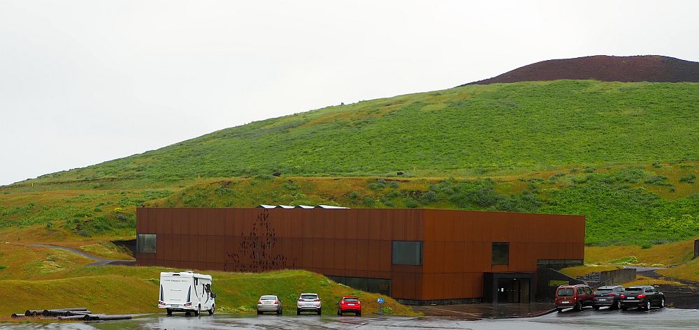
Eldheimer Volcanic Museum tells the story of this eruption and how the town dealt with it from the evacuation through the recovery. The museum is located right next to and below a lava field left from the eruption.
This lava field still covers many houses, and the museum is built around a single excavated house. Entering, this is the first thing visitors see: a ruined house, inside a much larger, almost warehouse-like space.
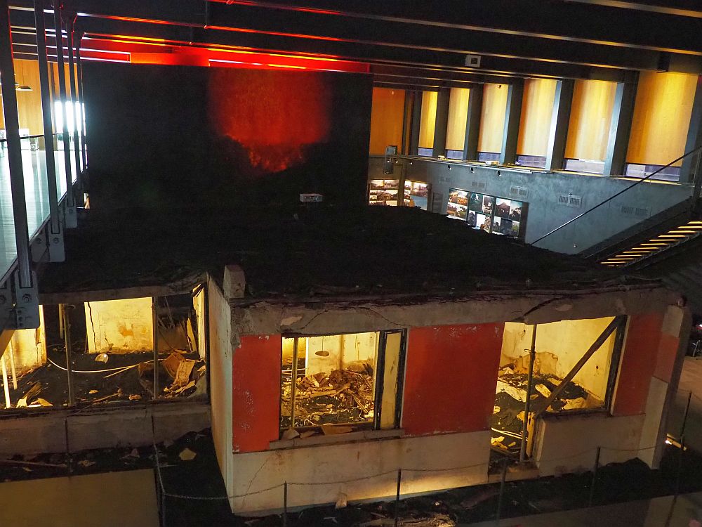
Screens in front of the ruin show information about the people who lived there, how they escaped, and the objects that excavators found that were still identifiable and intact. We could walk all the way around the house and peer in the windows, imagining a very ordinary middle-class family who lived there.
The rest of the museum tells the larger story through an audio tour, photos, videos of the night of the evacuation, first-hand accounts and so on. It’s a dramatic story, delivered in a factual, unsentimental way. It goes on to tell about how the town was rebuilt, taking advantage of how the eruption had changed the island: these new lava fields protected the town from the wind, they found, and also offered a ready source of building materials.
Surtsey Island
Upstairs, an exhibit tells about another island called Surtsey, which came into existence in 1963 due to an undersea volcanic eruption. Now a UNESCO site, it is southeast of Heimaey and uninhabited. It has been protected by law since its birth, when it was a dead island: just a lump of cooled lava. Its importance is in its usefulness in learning how species colonize new land without human interference. The only humans who get to go there are scientists surveying the development of species on the island.
Eldheimar Volcanic Museum: Suðurvegur / Gerðisbraut 10, Vestmannaeyjar. Open Wednesday-Sunday 13:30-16:30. Admission: Adults ISK2600 (€16/$18.50), children 10-18 ISK1300 (€8/$9). Tickets.
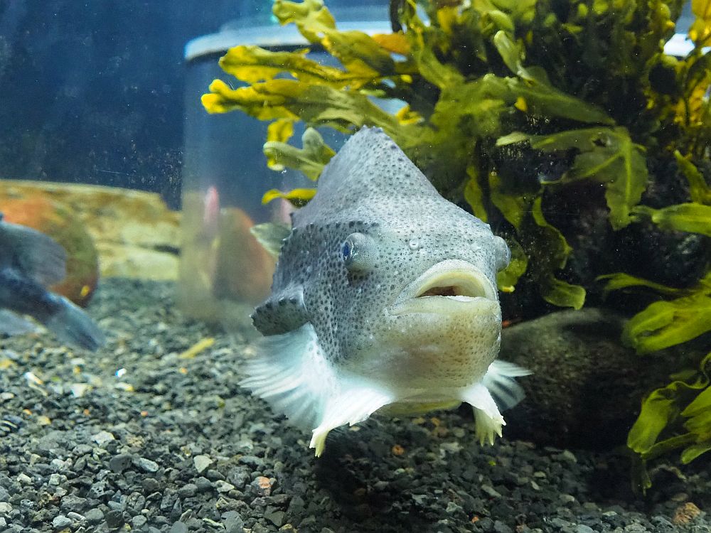
Sea Life Trust
In its visitor’s center in town, Sea Life Trust’s few aquariums show local fish, starfish, anemones, and the like. You can also see their puffin rescue center, where oiled birds are cleaned before being released, and where the townspeople bring pufflings (baby puffins) that are lost. Pufflings get disoriented at night because of the lights of the town and don’t know how to find their way back. Townspeople keep them for the night and then bring them here for weighing. Then they release them again at the shore in the daytime.
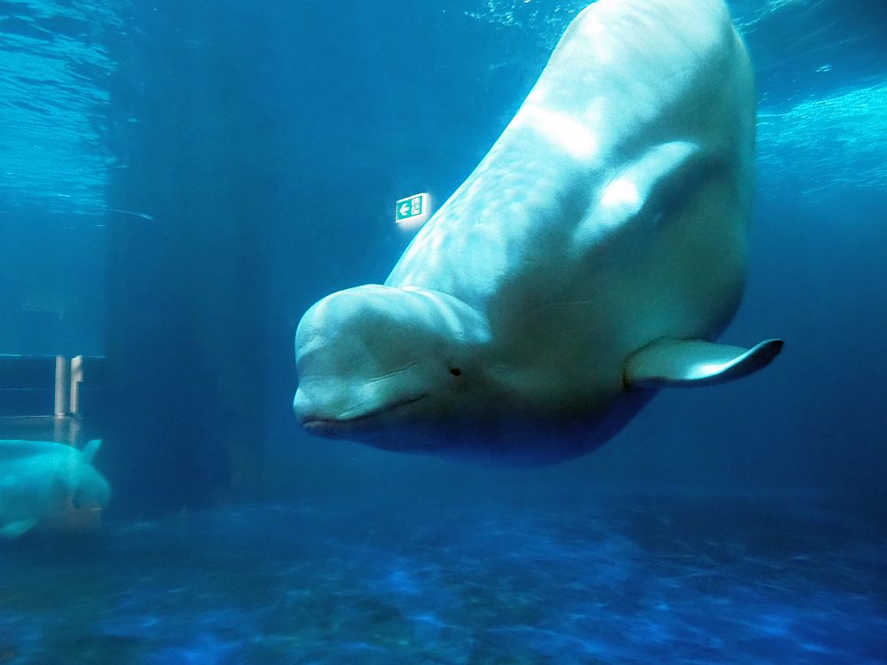
The primary purpose of Sea Life Trust, though, is to serve as a sanctuary for beluga whales. To do this, the trust has transformed an entire bay called Klettsvik, quite near the town, into a massive enclosure. They installed netting to close it off from the sea, and pontoons as well to serve as access points for caretakers and scientists. The pontoons also reduce the effects of wave action. This bay-sized cage will be used to house whales rescued from aquarium shows.
The first inhabitants of Sea Life Trust’s new sanctuary are two beluga whales brought over from a Sea Life Aquarium in Japan. When we visited, Little White and Little Grey, who are anything but little, swam lazy circles around a quarantine tank, a sight that was somehow mesmerizing. The next week, they were released into their new home.
It’s not clear yet, apparently, whether they’ll ever be able to be released into the wild, or whether they’ll spend their lives in this bay. Some long-term observation within the bay will be necessary.
You can visit the visitor’s center to see the aquariums and pufflings, if any are in residence, and to learn about the sanctuary. The Trust has also begun to offer boat trips out onto Klettsvik Bay to see Little White and Little Grey. Having seen them up close in their quarantine tank, it sounds to me like the boat trip would be well worth taking.
Sea Life Trust: Vestmannaeyjar Harbor. Open April to October. Boat tours daily at 13:00. Visitor Center admission: Adult ISK3000 ((€18.50/$21.50), children 6-12 ISK2000 (€12/$14). Visitor Center and bay trip: Adult ISK7500 (€46/$53), Children 3-12 ISK5000 (€30.50/$35.50). Website.
Puffins
As I already mentioned, the whole reason we decided to go to Heimaey was to go to the south of the island, where a peninsula serves as a puffin sanctuary. Grass-covered steep cliffs offer perfect nesting places for puffins, and the summer is when they nest.
One road goes to this southernmost tip of the island and climbs the hill at the center of it called Stórhöfði. Stórhöfði is also known to be the windiest place in Iceland.
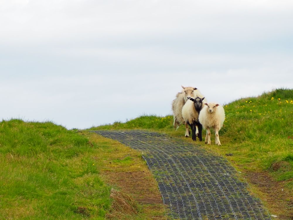
If you drive out to Stórhöfði, there are two places to park: one at the very end of the road at the top of the hill, and one a few hundred meters before that. We stopped at the one below the top first, and were very glad we did. Following a short path – past three welcoming sheep – we came to a small building. The path ended at its door, so we went in.
It turned out to be a bird blind, a.k.a. a bird hide: a small building that allows birdwatchers to observe birds without disturbing them. It sat on the edge of a steep, grass-covered hill, where puffins nested. We could look out windows at the scene, or we could slide open small doors and look without the glass between: perfect for photos.
It was an extremely windy day in an extremely windy place, so we were glad to have the relative shelter of the bird blind and, at the same time, we could see the puffins, sometimes quite closely. At one point a puffin sat himself down closer to the bird blind than any of the others and I was able to take some lovely shots.
Eventually we decided to move on, and drove up to the top of the hill. From there we could follow a path down to the edge of the cliffs and follow that around the hill as far as we wished before circling back up to the car park.
It was a windy, wide-open view over the sea and over the rolling, grass-covered sides of the hill. It was austere and beautiful and chilly.
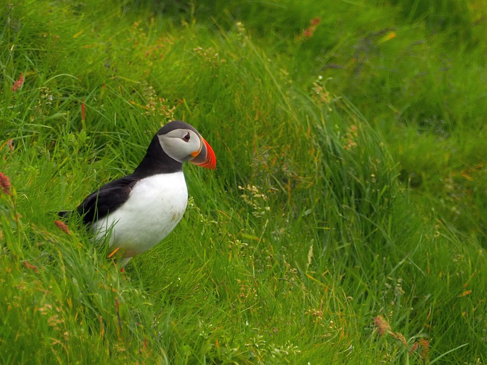
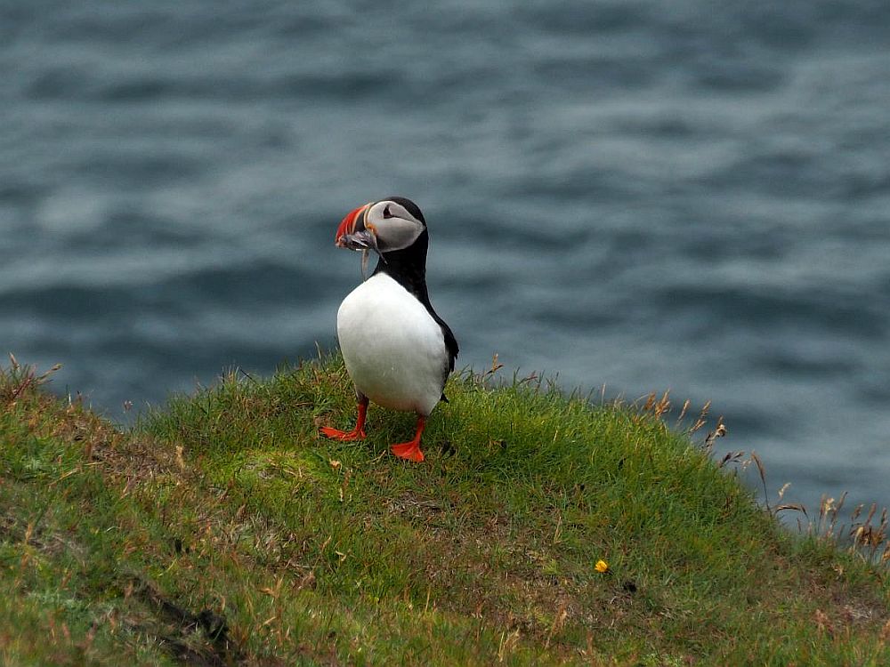
Suddenly, we came upon a puffin. We’d been seeing them all along, flitting by in the air, but didn’t expect to see any still ones, since their nests were out of reach and out of sight over the edge of the cliffs below us.
This bird, though, seemed to be posing. It stood right on the edge of the cliff, holding several small fish in its mouth. It looked at us and looked around and didn’t seem worried at all.
This allowed me to take another series of photos, amazed at my luck.
If you’re going to do this walk around the peninsula, I’d suggest wearing warm clothes and a warm hat as well. Waterproof clothing would be best, in case it rains.
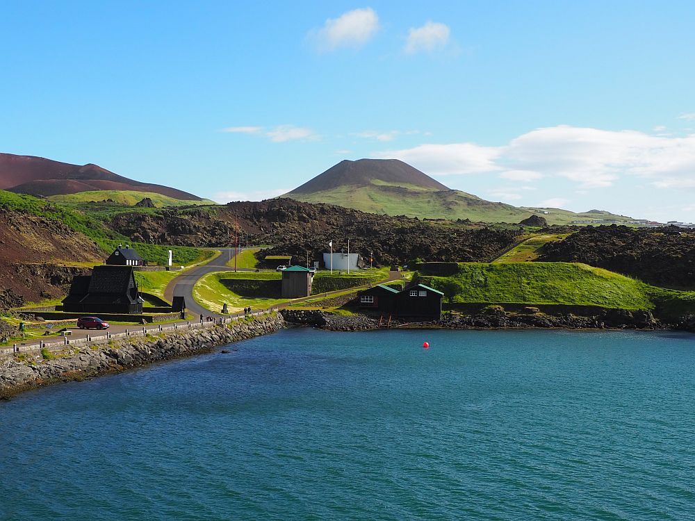
Herjólfur’s Farmhouse
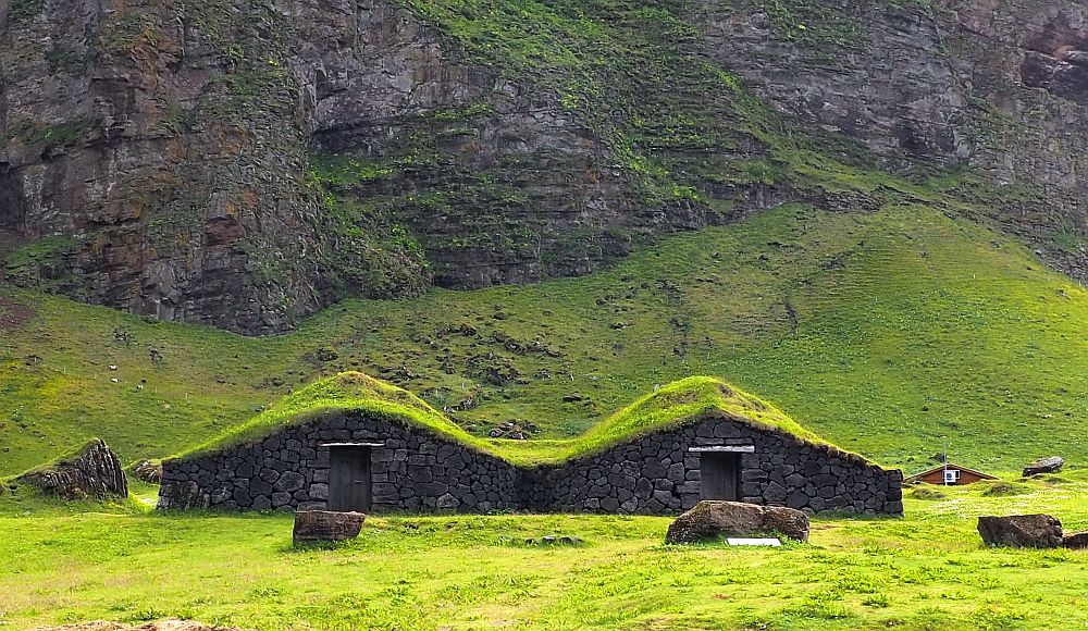
This recreated farmhouse is based on information from an archeological excavation nearby of a group of houses dating to the 9th century. This predates most other evidence of humans in Iceland. They were likely Vikings from Scandinavia.
The reconstruction is in the form of a turf longhouse, or rather two connected longhouses. The roof is turf as well, supported on wood beams. The people lived in one part and the livestock in the other.
Hiking
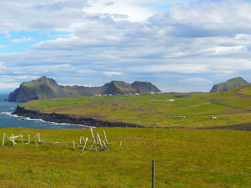
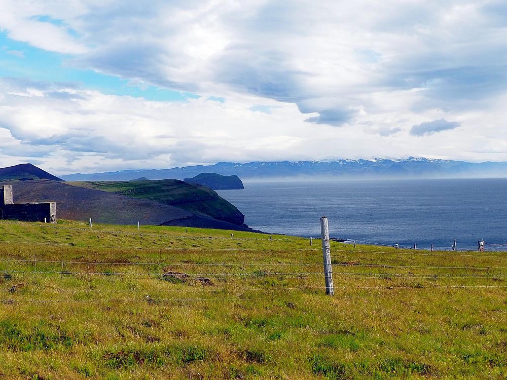
We hadn’t actually planned to do this, but Herjólfur’s Farmhouse sits in a green bowl of a valley edged on one side by a curved mountain ridge called Blátindur mountain. If you look back up at the first photo in this article, you’ll see the mountain in the background, with the ridge along its length. We saw people climbing up to the edge of the ridge and decided to try it ourselves. I was curious what the view would be like from up there.
We had two choices: on the left edge of the bowl from where we stood was a zigzagging trail up the side to the ridge that connects the higher peaks. Another path on the right appeared to go directly and very steeply up the side. We chose the left-hand one.
It was a tough hike for me because it was so steep. In places, plastic mats had been placed to step on, but most of it was just a rocky path. We went slowly, stopping often for me to catch my breath. I made full use of my walking sticks and my husband spent my pauses birdwatching.
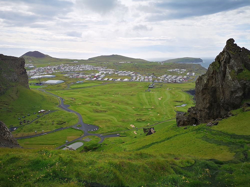
As we neared the ridge’s edge at the top, we talked about what we’d do. We thought we might walk a bit along the edge, where we guessed we might find a path. The view over the ocean might be pretty, we figured.
That didn’t happen. I was climbing those last few meters ahead of my husband. As my head reached the level of the path along the ridge, the wind hit me.
Remember I mentioned how windy it can be in Heimaey? We’d forgotten as we climbed up the slope how windy it was that day, since the mountain blocked the wind.
Startled at the strength of the wind, I immediately dropped my head down and sat right down on the path, informing Albert that I would not go a step higher. Passing me and climbing up, he soon realized I was right. He ventured a few steps on the ridge path but soon came back down, agreeing that it was simply too dangerous to attempt it.
There was nothing we could do but return the way we came, down the zigzag path.
If you decide to walk the ridge, prepare better than we did. Go on a relatively calm day, and bring walking sticks, water to drink, and some snacks. Bring a hat and gloves to wear, and good strong shoes. Apparently parts of the ridge path have been enhanced with ropes you can use for support.
Heimaey was just one stop on a three-week road trip around Iceland. See my 3-week Iceland itinerary to learn about all the other places to go in Iceland.
Other hiking trails
There are other places with hiking trails on the island that we didn’t have time for. One of them is Heimklettur, the highest point on the island at 283 meters high. You’ll pass it as you arrive on the ferry: it’s the tall spit of land on your right as you come into the harbor. Apparently the trail has been improved with ladders, steps and chains for support.
I’ve already mentioned the one that goes up Eldfell, the new volcanic hill (221 meters) formed by the 1973 eruption. That trail also leads you along the edge of the lava fields above the town. The other one I’ve already mentioned is the one that goes up and around Stórhöfði at the very southern tip of the island. We only did part of that one.
Another trail in the south of the island below the airport, but not all the way south, leads hikers parallel to the eastern shore. And another offers a short climb up Helgafell hill (226 meters).
Heimaey stave church (Stafkirkjan)
Skansinn is an area near the original harbor. It’s also the place where the 1973 lava flow stopped and where Heimaey stave church sits picturesquely looking out at the harbor and across to Heimklettur mountain.
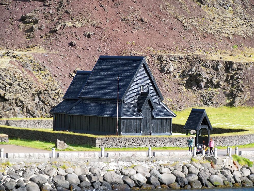
Heimaey stave church is not an original church or even a reconstruction. Rather, it is a replica of a Norwegian church, Haltdalen. Norway gave it to Iceland in 2000 on the occasion of the 1000th anniversary of Iceland’s conversion to Christianity.
The church is entirely wood, all brought over from Norway. It has an interesting double shell: in other words, there are two layers of walls, with a space between them wide enough for a person to walk between. The altarpiece is a replica of a medieval one, also from Norway.
Landlyst Medical Museum
Next to the stave church is the Landlyst Medical Museum. Apparently Iceland went for generations without any medical care of any sort, until a local woman, Sólveig Pálsdóttir, went to Denmark in 1842 to study midwifery. When she had finished training, she came back to Heimaey and founded a birthing center. A few years later, a Danish doctor joined her. The two of them particularly focused on fighting neonatal tetanus, which had been killing three out of four children. Between them they managed to almost eliminate neonatal tetanus.
It’s a tiny building, and only takes about 10 minutes to see. A few original medical instruments and medicines are on display along with a bit of the history of medical care on the island.
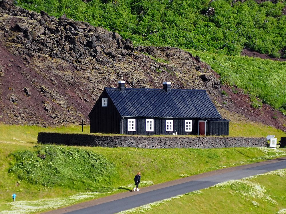
The building dates to 1848, built by Pálsdóttir’s husband, and is the second oldest building on the island after the church in town called Landakirkja. It was moved to this site in Skansinn in 2000.
Landlyst Medical Museum: Skansinn, harbor area. No fee.
Pirates
Obviously, you won’t see any pirates on Heimaey. However, across the road from Landlyst you can see the ruins of old defensive walls, and these are related to a pirate attack that happened way back in 1627.
The pirates in question were Turks from Algiers in North Africa. In 1627 they captured the island: first raiding the east of Iceland, then landing here. They took 234 of Heimaey’s inhabitants captive, taking them back to Algiers. There, they were sold into slavery. One managed to escape while 34 more were ransomed.
Because of this, a fort was built here at the harbor to defend against future Ottoman raiders, but fortunately they never returned. Not much of the fortification is left.
Here you’ll also notice a ruined 20th-century water tank, half buried by lava from the 1973 eruption. Large tanks like these were filled with clean seawater and used in processing fish.
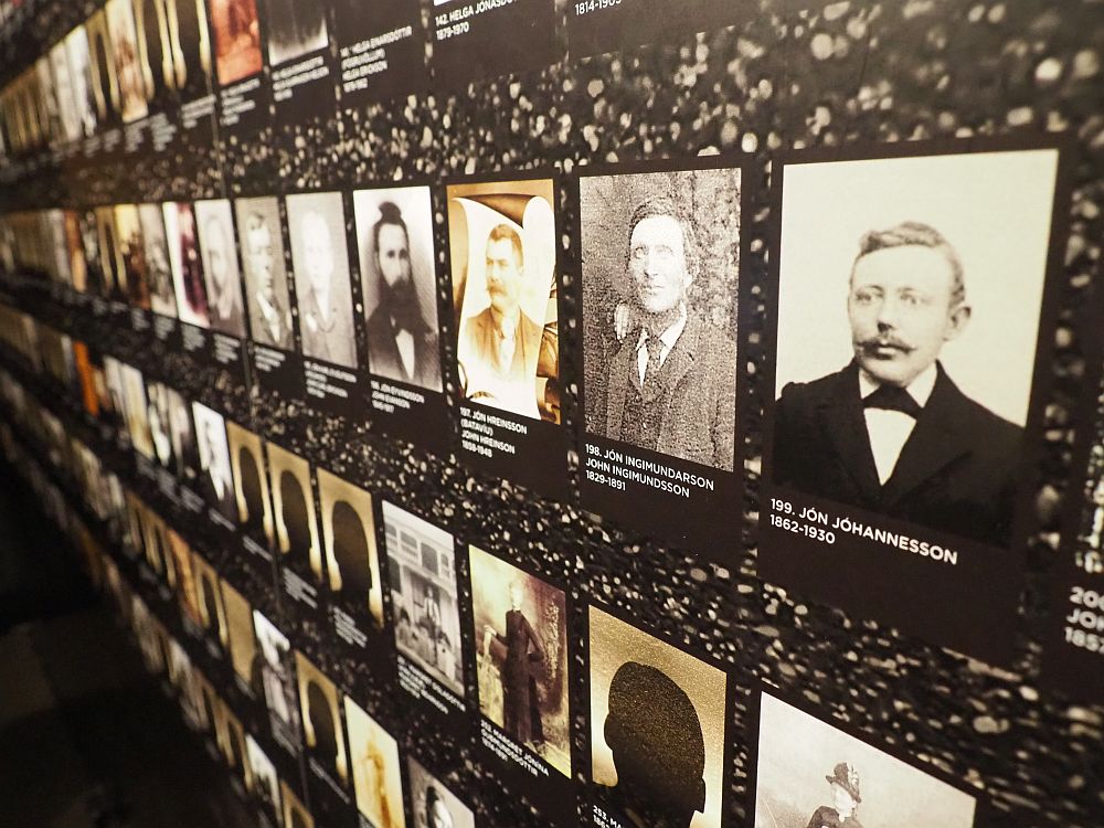
Sagnheimar Folk Museum
The folk museum in Heimaey is upstairs above the town’s library. It’s much like many local museums: a bit of a mishmash of topics and items. For history, it covers the 1627 pirate raid and the 1973 eruption as two key events in the island’s history.
Another section draws the connection between the Mormon religion and the island. About a quarter of the island’s population emigrated to the US in the late 19th century, and many converted to Mormonism.
You can also learn about and see films from the 1936 Olympics: the famous one in Berlin where Jesse Owens, a black track and field athlete, angered Hitler by winning four gold medals. What is less known about that particular Olympics is that four Icelandic men also competed in track and field events. While none of them earned a medal, two of the four were from the Westman Islands, clearly a proud moment for Heimaey.
The museum focuses a lot of attention on the fishing industry in the island’s history: exhibits include a sailboat and other tools of the trade, and information on the fish processing industry on the island. A replica of typical laborer’s quarters, complete with Farrah Fawcett poster, gives an idea of how people working here might have lived. It also looks at the dangers of fishing and some of the ways it can be made safer. The video of a fishing boat in high waves is enough to make one seasick without even boarding a boat.
The museum has some multi-media elements and is pleasant to wander through. It’s well-presented, if a little text-heavy, all labeled in both Icelandic and English.
Sagnheimar Folk Museum: Hasteinsvegur, upstairs from the library, Heimaey. Open daily May-September 10:00-17:00, October-April only on Saturdays 13:00-16:00. Admission: Adults ISK1000 (€6/$7), children under 18 free. Website.
Other things to do on Heimaey Island, Iceland
There are several other possibilities on Heimaey that we didn’t get to do:
- Visit the hidden beach at Stafnes. You’ll either need to climb up and over Blátindur (and back!) or take a boat. You’re unlikely to want to swim in the frigid North Atlantic water, but I’ve read it’s a pretty place when the weather is good.
- Play golf on a very windy 18-hole golf course.
- Take a swim in the town’s swimming pool, which has a salt water pool, hot tubs, sauna and waterslides.
- Take a walking tour over the lava to learn about the 1973 eruption.
- Rent a bike or e-bike and explore the island.
- Take a boat tour to see the island from the sea.
Map of Heimaey island, Vestmannaeyjar, Iceland
I’ve added all of the places mentioned in this article to this google map.
Taking the ferry to Heimaey
A ferry runs between the towns of Landeyjahöfn on Iceland’s “mainland” (or should I say “main island”?) and Heimaey seven times a day. The journey takes 40 minutes. I booked our place, including for our car, several weeks in advance. I gather that reservations are less likely to be necessary if you don’t take a car. Ferry website.
If you’re wondering how it was to travel to Iceland during the pandemic, read my article about my experience on the Pink Pangea website.
However, things didn’t go so smoothly. The ferry workers announced a strike for the day of our booking. I was able to call and change our reservation for a day later quite easily.
We ended up taking a somewhat earlier boat and moving our return reservation to late afternoon the following day. We were concerned that having only one day and one night would not be enough time to see Heimaey properly, but by changing our return time, we had plenty of time to see what we wanted to see.
I’d certainly recommend staying at least two nights, however, to have time to enjoy more of the scenery and do more walking.
We experienced the ferry twice: once in quite bad weather and once is beautiful weather. The way going, with the high winds making the water very choppy, was not particularly comfortable. The boat was crowded because no one sat outside, and quite a few were looking rather ill.
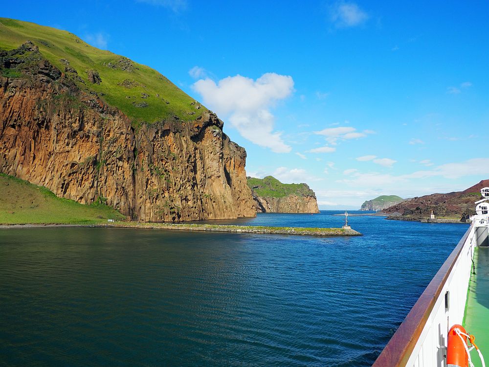
It’s a short ride, though, and the boat is modern and comfortable. We just didn’t see much of the scenery we were passing until the way back.
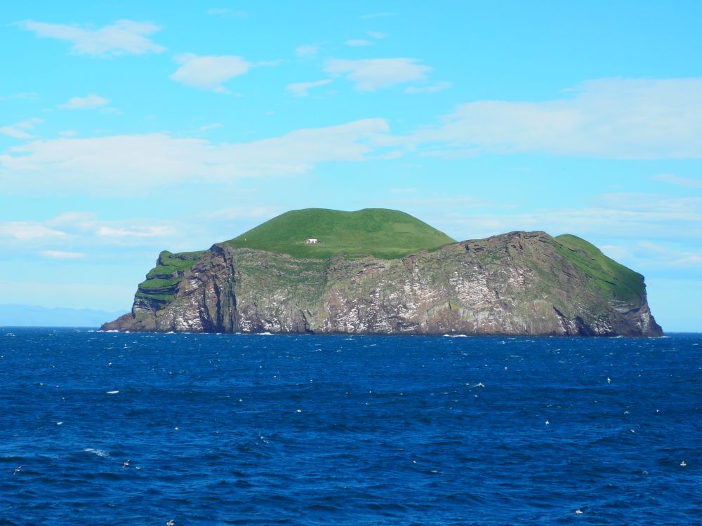
The route passes several of the smaller islands of the Vestmannaeyjar archipelago: very striking sights, with their cliff edges and green tops. Some have a single house on them, which I later found out are old hunting cabins, now used by cooperative groups as vacation cabins.
Is Vestmannaeyjar worth visiting?
Definitely. Besides all these things to see, its just a really pretty place, as is the ferry ride to get there.
Where to stay?
You can book a guesthouse or hotel by clicking on the map below (Zoom out to get an overview of the whole island.):
We stayed at Guesthouse Arny and liked it. The owner was friendly and answered lots of questions for us. The room (a studio but with a shared fridge and bathroom in the hall) was clean and comfortable, with proper blackout curtains, unlike quite a few places we stayed in Iceland.
Do you need to take a car to Heimaey island?
No, you don’t really need a car. Everything is in walking distance, or you can rent a bike to get around more quickly. Especially if you stay for two or more nights, the car isn’t necessary.
Having said that, with the rain we experienced on our first day there and the unusually strong winds on our second day (even locals agreed it was unusual), we were glad to have the car.
How much time to spend on Westman Islands?
I’d say at least two nights, though three would be better if you want to do more hiking than we had time for.
If you found this article useful, please share it around!

Rachel Heller is a writer living in Groningen, the Netherlands. She is the owner and primary author of this website, Rachel’s Ruminations, a travel blog focused on independent travel with an emphasis on cultural and historical sites/sights. Read more here about her and about this website. All photos in her articles are her own, unless otherwise specified. Rachel also owns and operates a website about World Heritage travel.
Lovely views and it’s good to know that there is no need to take a car to Heimaey island.
I am so jealous! We wanted to get out here (for the puffins, mostly) and the weather did not cooperate. (And our schedule wasn’t very allowing either.) It looks like you had beautiful weather and found more than puffins to keep you occupied!
hello, I have interest to take pictures of the Drindakar lighthouse, do you know if this is possible. thank you
I assume you mean Þrídrangaviti Lighthouse? I don’t think so. Though I suppose if you hired a helicopter they might be willing to take you there …