Iceland waterfalls that are easy to reach from the ring road
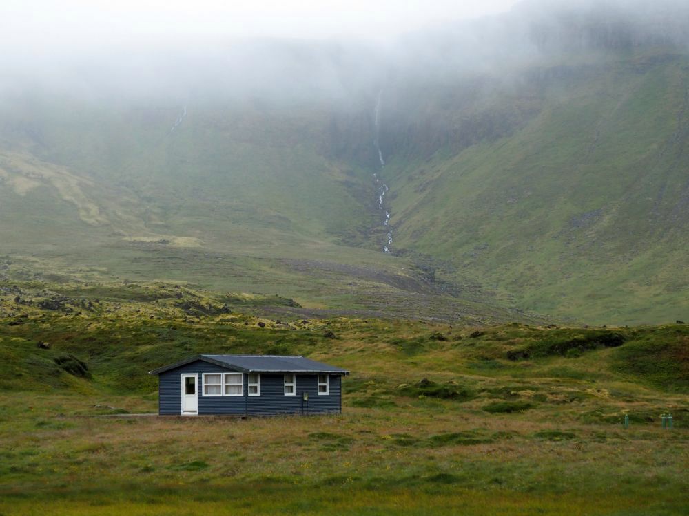
In the summer, when we did our three-week road trip around Iceland, we saw waterfalls every single day. Some were small rivulets snaking down a hill; others were long, narrow streams plummeting off a rock cliff. These are not what this article is about.
Certain waterfalls in Iceland are so beautiful they have become destinations of their own. Many of these most beautiful Iceland waterfalls are easy to reach from the ring road that circles the island. Those are the ones we visited on our trip.
Disclosure: This article contains affiliate links. If you click on one of these links and spend money, I will receive a small commission. This will not affect your price.
Below is a list of those we saw, moving in a counter-clockwise direction around the island. At the bottom of the article you’ll find a map, so you can see where they are, and a video, so you can see some of them in motion rather than only in pictures.
All of these waterfalls are reachable with a two-wheel-drive car and many of them do not require serious walking either.
You’ll need a car if you want to see more than just a couple near Reykjavik. Compare rental car prices from Reykjavik airport here.
I’ve included a note on wheelchair accessibility on each one, but I don’t use a wheelchair so to some extent it’s guesswork. We visited in the summer when there was no chance of ice or snow, and I suspect that some of these that might be accessible in the summer with a wheelchair would not be so the rest of the year. Also, the weather makes a difference for both walking and rolling: too much mud could slow or stop your progress.
Gullfoss
Gullfoss is a spectacular two-part waterfall. Unusually, visitors view this one from above, walking down from a car park that is higher than the falls. It’s not a hard walk, perhaps one or two hundred meters along a well-maintained path, but includes some stairs so it isn’t wheelchair accessible. Wheelchair users can use another, smaller carpark (not the one with a restaurant) to get a view.
The waterfall is wide and awe-inspiring in terms of the sheer quantity and force of the water flowing over it. In the upper part, the water doesn’t fall very far, but the width of the rapids means an enormous amount of water tumbles over the wide, irregular shelf.
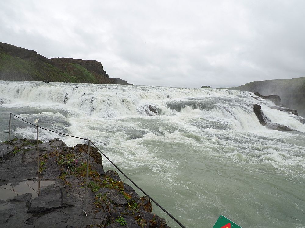
It lands on a relatively flat triangular rock shelf for a moment, then takes a much deeper plunge straight down off a side of the triangle. The force of the water throws clouds of mist into the air. The constant roar means that you have to shout to be heard.
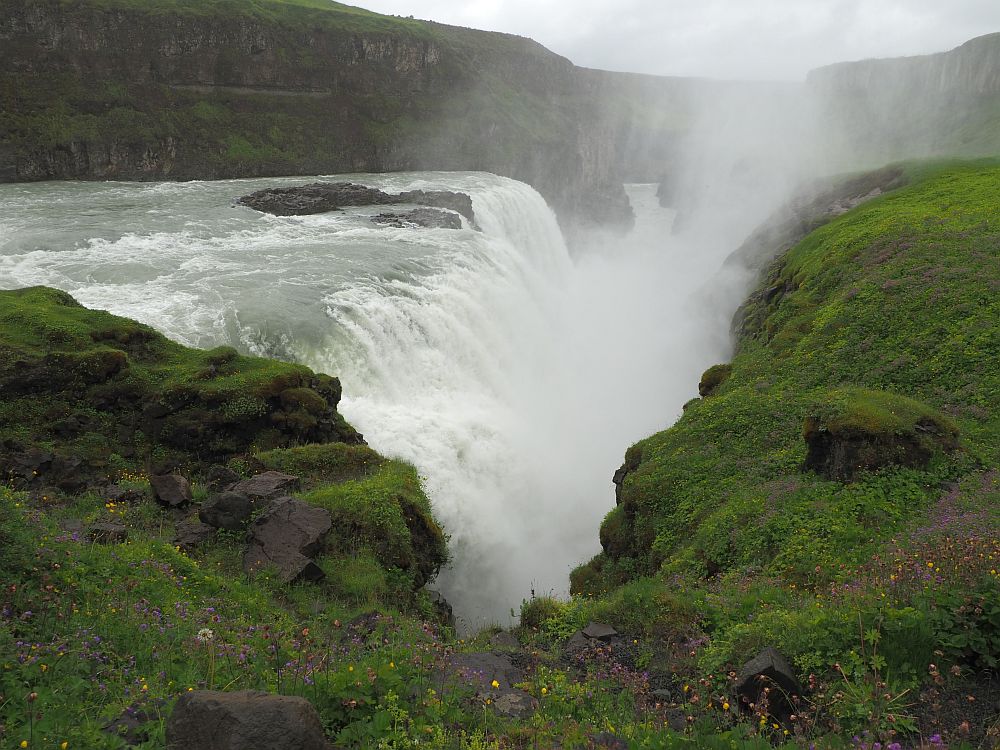
Following the path allows you to see the waterfall from various angles: from the side where the water plunges straight off the lower shelf, or from alongside the rapids on the upper part of the falls. It’s magnificent.
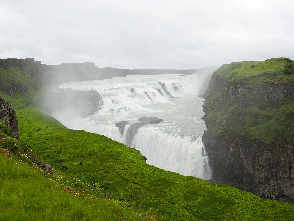
Gullfoss: Continue past Strokkur Geyser on route 35. Always open. Visitor center open during daylight hours. No fees.
Bruarfoss
We saw Bruarfoss the same day as Gullfoss, which required about a 25-minute drive from one to the other.
A new parking lot at Bruarfoss makes it much easier to reach than when we were there. It’s right next to the waterfall.
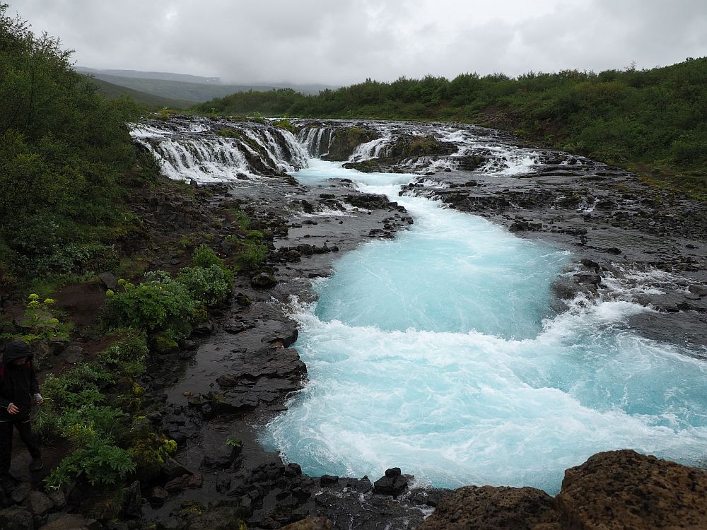
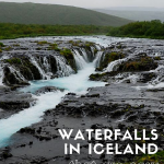
The first glimpse of Bruarfoss is a “wow-moment.” Blue rapids tumble down a rocky slope, but a central cleft forming a narrow canyon splits the rapids in two. From all along both sides, the water spills down into the central cleft.
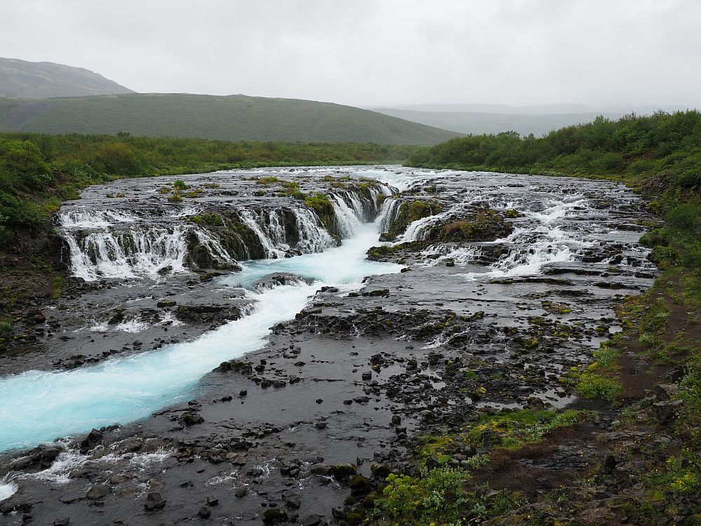
I’ve read tourism websites that say that the blue of the water is because it is formed from glacial melt water. I don’t fully understand, though, why this one is blue while many other waterfalls and rivers in Iceland form from glacial melt water and they aren’t all blue. In any case, even on an overcast day, there is a distinctive blue tint. It must be quite bright on a sunny day.
A bridge across the river allows a great view of Bruarfoss. You can also go under the bridge on the far side of the river for a slightly lower angle.
Bruarfoss: Open all the time. Fee for parking. Use the Parka app or website.
Read lots more about things to see in Iceland in these Iceland articles. Or check out my 3-week Iceland itinerary!
Haifoss
The good part about Haifoss waterfall is that you can drive almost right up to it. The bad part is the state of that road. Haifoss is the only waterfall on this list that involves a judgement call about whether to drive there or not.
Route 332 is unpaved and posted with a sign calling it “Impassable.” We had only rented a small two-wheel-drive car. The rental agency had warned us that we were not, under any circumstances, allowed on “F-roads,” which is, essentially, all of the roads in the middle of the country.
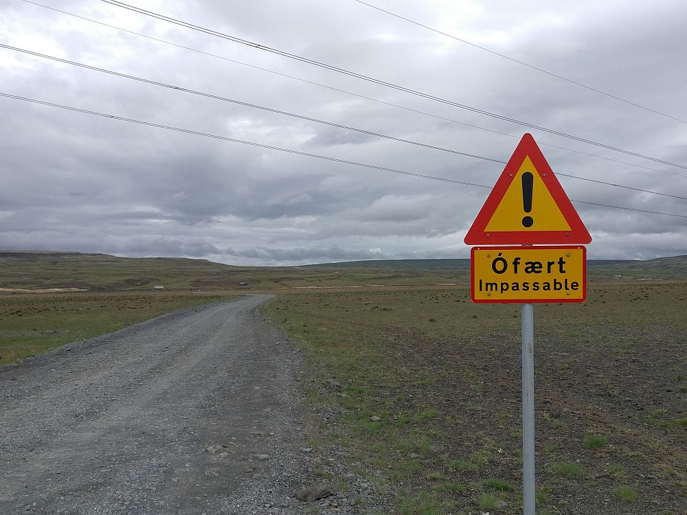
This isn’t an F-road, but a paper we found on the seat when we first picked up the car stated that if we went on a route marked as “impassable” and ended up needing service, we’d get a high service charge.
After sitting at the end of the road debating whether to try it, we decided to go ahead, but to drive extra slowly and carefully. Our other option would have been to walk the 7.5 kilometers each way (4.6 miles) – not something I was prepared to do – or hitchhike. Given that we saw no one else the whole time we sat and discussed this, hitchhiking didn’t seem a viable option.
Other people did arrive while we were at the waterfall, so hitchhiking might well have worked. In a normal summer season – we were there during the pandemic – you could probably hitchhike up this road quite easily.
It didn’t turn out to be a very bad road, although if we’d had any heavy downpours it might have been much worse. It was gravel and rock and had lots of potholes and corrugations, but we just took it very slowly, taking about 20 minutes each way.
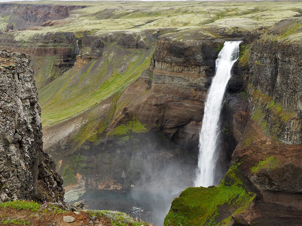
Was it worth it? Yes, definitely. From the carpark at the end of the road, it’s a short walk to see not one but two waterfalls.
The path ends near the edge of a canyon cut over time by the two waterfalls. On the far side of the canyon, on the left, is Haifoss. On the right: Granni waterfall. Both are very long, narrow falls, pelting a long way down into the canyon, forming a river that flows away to the left.
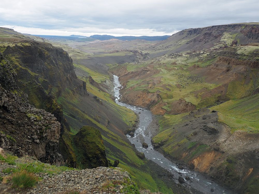
We were surprised to see a small field of snow to the right of Granni, even though it was mid-July.
For a while it was just the two of us and the sound of the two falls. It was lovely and somehow mesmerizing.
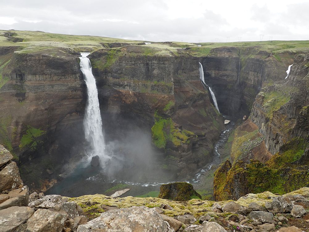
The road ends near the falls, and it’s only a five-minute walk from the parking place to a view of the falls. The path is similar to the road: a bumpy, gravelly dirt path. With a heavy-duty motorized wheelchair you should be able to get close enough to the falls for a view, if it’s not icy or snowy or too muddy.
Haifoss: Always open. No fees.
Seljalandsfoss
Seljalandsfoss is a popular one for tourists, for three reasons:
- its location right on the ring road, so it’s easy to get to as part of any “golden circle” tour of Iceland,
- the fact that it’s a beautiful waterfall, plunging straight down off a cliff for 65 meters (213 feet), and
- the fact that you can walk around behind the waterfall, making it a great place for selfies.
The water, as it descends, makes everchanging forms, depending on how much water there is and on how the wind blows. The sheer quantity of water when we visited in July – when the ice at upper elevations is melting – was awe-inspiring.
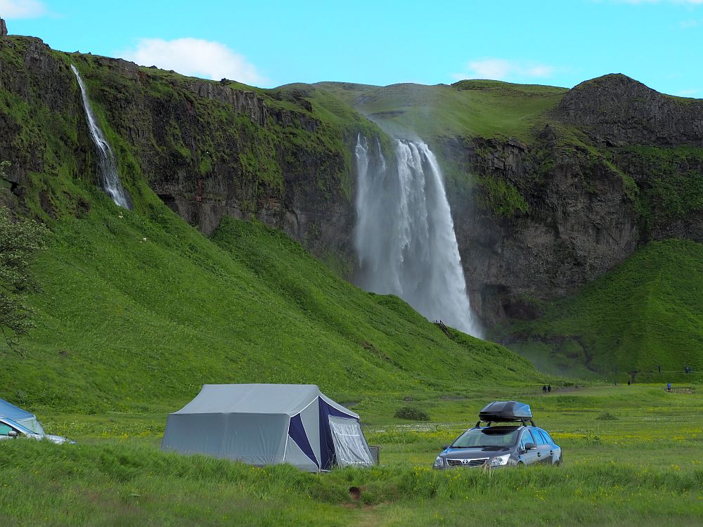
This was the only waterfall we visited that had its own parking fee. The fee covers the whole day, but we didn’t intend to stay long enough to make it worthwhile, so we just took a picture or two and left. Seljalandsfoss has good wheelchair-accessible paths.
Seljalandsfoss: Always open. Parking fee per day. Pay on-site or via Check-it.
Gljúfrabúi
Gljúfrabúi (or Gljúfurárfoss) is a short walk along the cliff from Seljalandsfoss, and the water flows off the same high land mass. We liked it better, though, because of how it is positioned inside a cleft in the cliff.
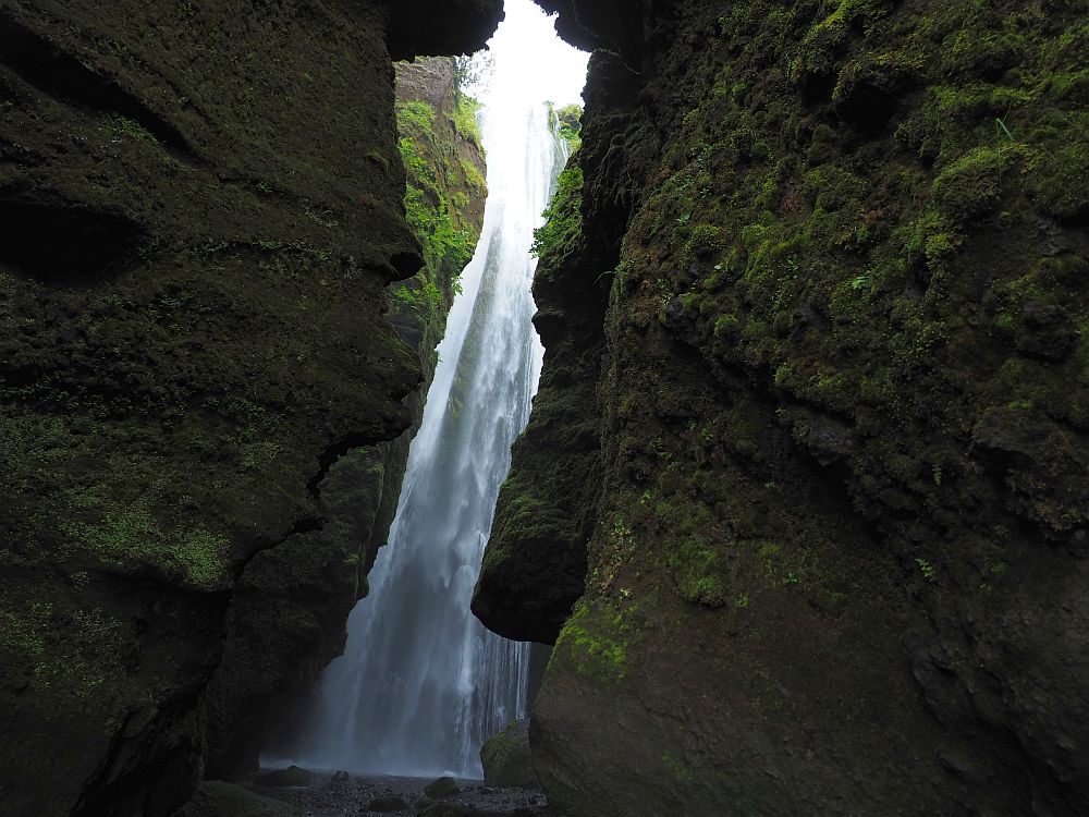
Gljúfrabúi is barely visible from the road. In order to see the whole height of the waterfall, you have to walk along the edge of a stream that flows between two vertical cliffs. The waterfall hides behind this cleft. You stand next to the little stream, your shoulder against the cliff wall, in the dark shade of the cliffs on either side. The waterfall, though, is out in the open air, and if the sun shines, it dazzles. Gljúfrabúi may be smaller than Seljalandsfoss, but to me it is far more beautiful.
You can view Gljúfrabúi from a wheelchair outside the cleft in the cliff, but the path is too narrow and rocky between the cliffs for a wheelchair to enter.
Gljúfrabúi: Always open. Shares parking with Seljalandsfoss. Pay on-site or via Check-it.
Skogafoss
Skogafoss is a long (62 meters / 203 feet), wide, straight waterfall much like Seljalandsfoss, and similarly elegant. In the little town of Skogar, right off the ring road, it is different from the others in that it allows two views. You can see it easily enough from the bottom. But you can also climb up a long stairway built into the hill to its right. From the top, you get a very different perspective. The bottom is wheelchair-accessible, though the road to the waterfall is a bumpy stone and dirt road, so I suspect that if there’s a lot of rain it wouldn’t be easy. The top is only accessible via stairs.
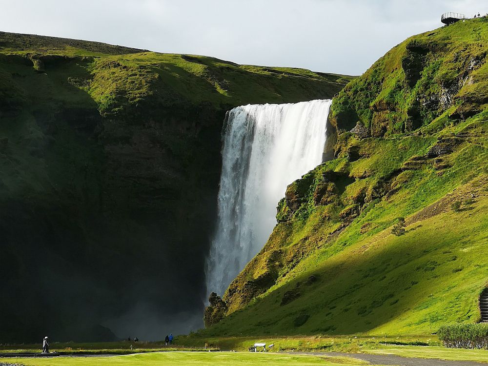
Skogafoss: Turn left from Route 1 into Skogar village; drive through the village and you’ll spot Skogafoss to the left. Always open. Pay the parking fee with the Parka app or website.
Kvernufoss
Kvernufoss was one of our favorites, mostly because it is less well-known than the others and we had it to ourselves for a while. The path approaching this one starts at the Skogar Museum and meanders along into the bottom of a canyon.
In July when we visited, it was green and lovely, and spotting that waterfall at the end of the canyon as we rounded a bend in the path was enchanting. It is tall and narrow, with less water flowing through it than Skogafoss, but nevertheless pounding down into the canyon below.
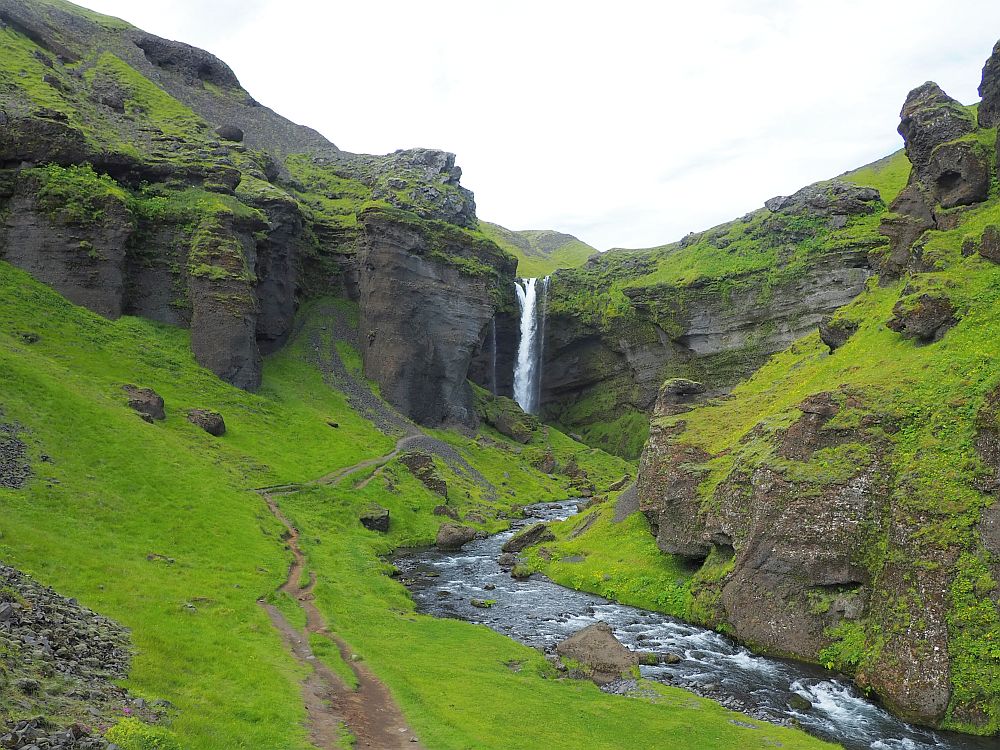
We took our time, since we had it to ourselves, and my husband followed the trail to its real end, almost behind the waterfall. Unfortunately, this waterfall is not reachable with a wheelchair. Getting there involves climbing over a stile and walking a very narrow, dirt footpath.
Kvernufoss: Open all the time. Pay the parking fee through the Parka app or website.
Dettifoss
Dettifoss and Selfoss are waterfalls in a single river. Both waterfalls can be approached from the east side or the west. From Route 1, Route 864 will take you to the east side of Dettifoss (about 32 kilometers /20 miles from the ring road) and Route 862 will take you to the west side (about 24 kilometers / 15 miles). The east route is entirely a dirt road.
I didn’t see Route 862, which approaches the falls from the west. Apparently it’s paved until Dettifoss, then gets very bad as it continues north. In the winter, both roads can sometimes close.
Anyway, I had read that you could see more from the east, so that was the side we chose – rightly, it turned out. This road was, at least when we drove it, distinctly better than the road to Haifoss, despite being a dirt road. I can imagine if it’s been raining a lot, you might want to skip it; a two-wheel drive car might struggle with a muddy road.
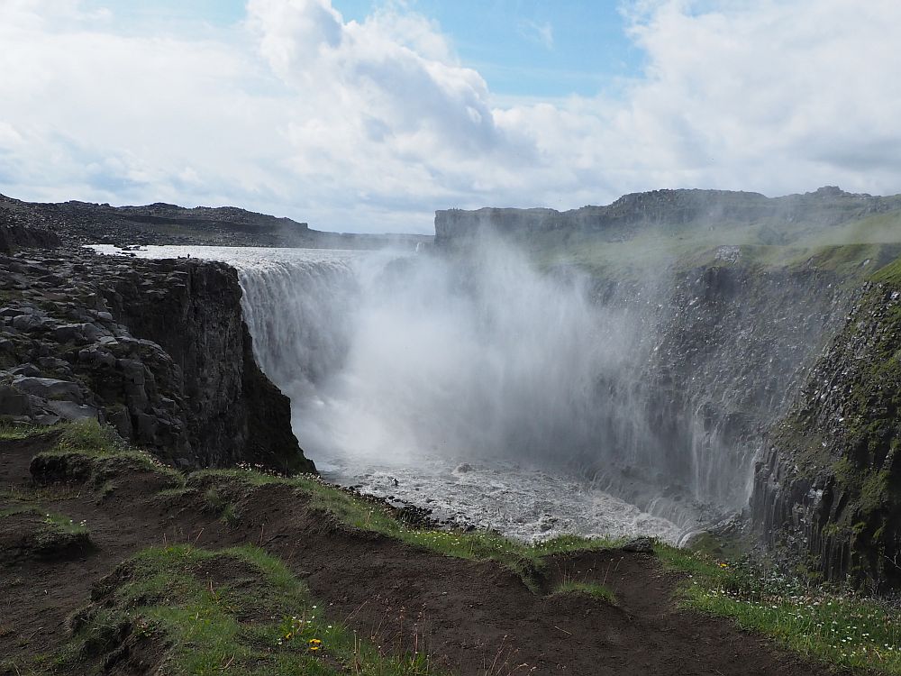
Dettifoss claims the honor of being the most powerful waterfall in Europe. Standing on a rock right next to the shelf the water plunges over, I could believe that. Dettifoss is 45 meters (148 feet) high and about a hundred meters wide (328 feet). So much water passes over it that a constant cloud of spray surrounds it. Its roar made me feel like the ground was vibrating under me.
I liked that I was able to see this waterfall from several vantage points: a broad overall view and also from right next to where the water churns over the ledge.
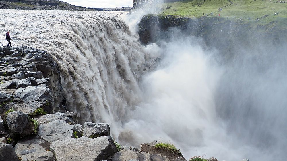
On the east bank, neither Dettifoss nor Selfoss is accessible if you have trouble walking a rocky trail. From the Dettifoss parking lot, it’s a short but rocky path to the river, then a rocky short walk along the river to the waterfall.
Selfoss
Selfoss is a bit more than a kilometer up the river from Dettifoss, and there is no road. Follow the trail of little wooden stakes topped with yellow. They’ll take you along a very rough path: sometimes a visible walking path, sometimes just rocks to climb over.
It’s worth the effort, even on a drearily rainy day like we had. Selfoss is a less powerful, less high waterfall (about 10 meters / 33 feet), but it’s really not just one: it’s a series of narrow falls all along a canyon wall, perhaps three or four times wider than Dettifoss. It’s quite a sight.
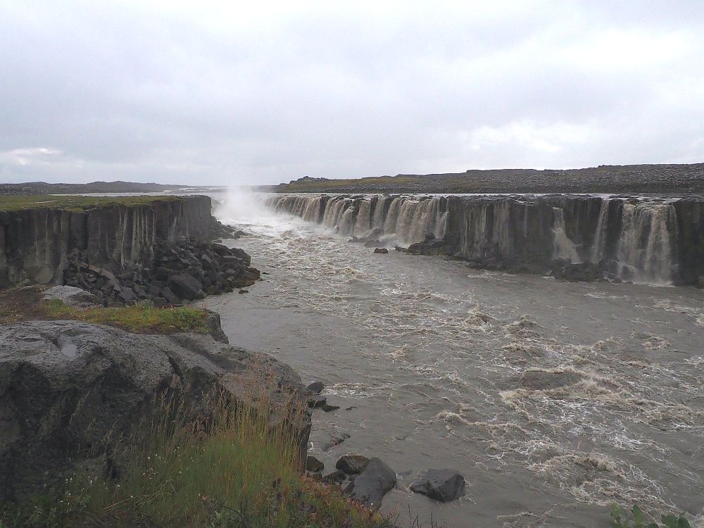
Selfoss is why the east side is better – unless you have all day so you can go see the west as well. From the west, apparently, you can get much closer to a subset of these little waterfalls, but most of them fall on the west side of the river, so you won’t see those. Where I was, on the east bank, I could see the entire array of falls at the curved end as well as all along the opposite side of the river.
Dettifoss and Selfoss: Always open except when bad weather closes the roads. Free parking, though the Vatnajökull National Park, where these waterfalls are located, seems to be planning to start charging for parking.
Goðafoss
Goðafoss is easy to get to, since it’s right on the ring road. This one involves a fall of about 12 meters (39 feet) along a curved shelf of rock. The falls is actually several along the shelf: two that are quite wide and a few narrower ribbons of falls. The water has a pretty blue tint, even on a cloudy day.
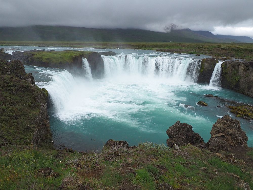
The amount of walking you do at Goðafoss will depend on how many different views you want. We were able to see it from a distance in its entirety from about the level of the top of the falls, and from a higher spot above and beside the falls. We could also descend to river level to look up at it. Moving further downstream, our view included a smaller waterfall called Geitafoss as well as the main one.
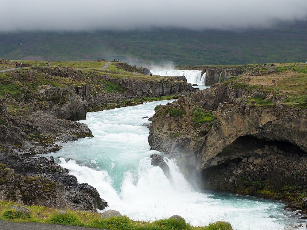
The main paths are wide and well-maintained, some paved, some gravel, and there are wheelchair-accessible viewing platforms. To get to the river level, though, involves stairs, so it is not accessible.
Goðafoss: Open all the time. Free parking.
Kirkjufellsfoss
After so many huge and powerful waterfalls, we weren’t as impressed with this one. It cascades prettily down a number of steps, next to a steep bare mountain called Mt. Kirkjufell. It’s an attractive waterfall, but not as awe-inspiring as some of the others for their height and/or power.
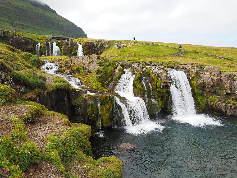
Looking at the mountain, I thought of how odd it seems to me that Iceland can have so much fresh water available and yet see so little plant growth. Of course, the reason is the volcanic soil, often relatively new, and the cold climate that allows only a very short growing season.
The often-seen postcard shot here is to the left of the waterfall (as you face uphill). You can get the waterfall and Mt. Kirkjufell next to it in one shot.
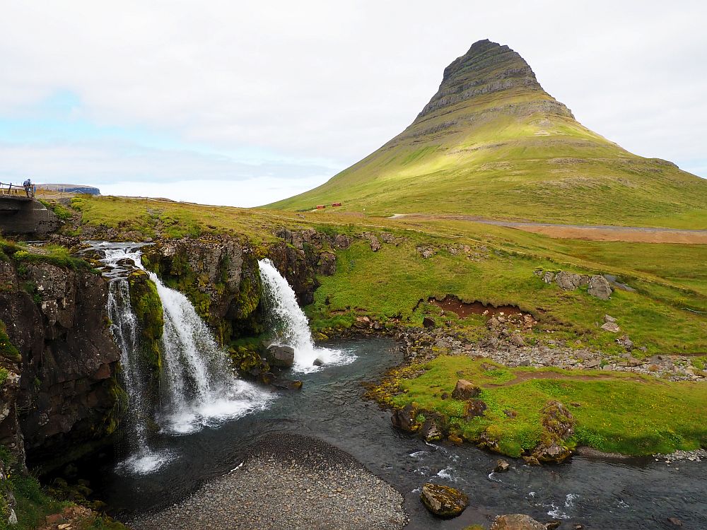
Anyway, if you happen to be passing by, Kirkjufellsfoss is worth a stop. The parking lot is at the bottom, and to see the whole cascade involves a short uphill walk. You can walk to the top and see it from above as well. The path is steep, so it may not be wheelchair accessible.
Kirkjufellsfoss: Route 54 along the north coast of West Iceland. Open all the time. Fee for parking at some points.
Öxarárfoss
Öxarárfoss is a small waterfall inside Þingvellir National Park, which you can read about in my article called 7 things to do in Thingvellir National Park. Compared to the rest of the waterfalls, it’s not terribly impressive. About 20 meters high (66 feet) and 6 meters (20 feet) wide, it tumbles off a cliff into a rocky pool in the gorge below. It is pretty, though, and has the distinct advantage of being easily accessible. The nearest parking lot is just a short walk away, and a wheelchair could reach it easily too.
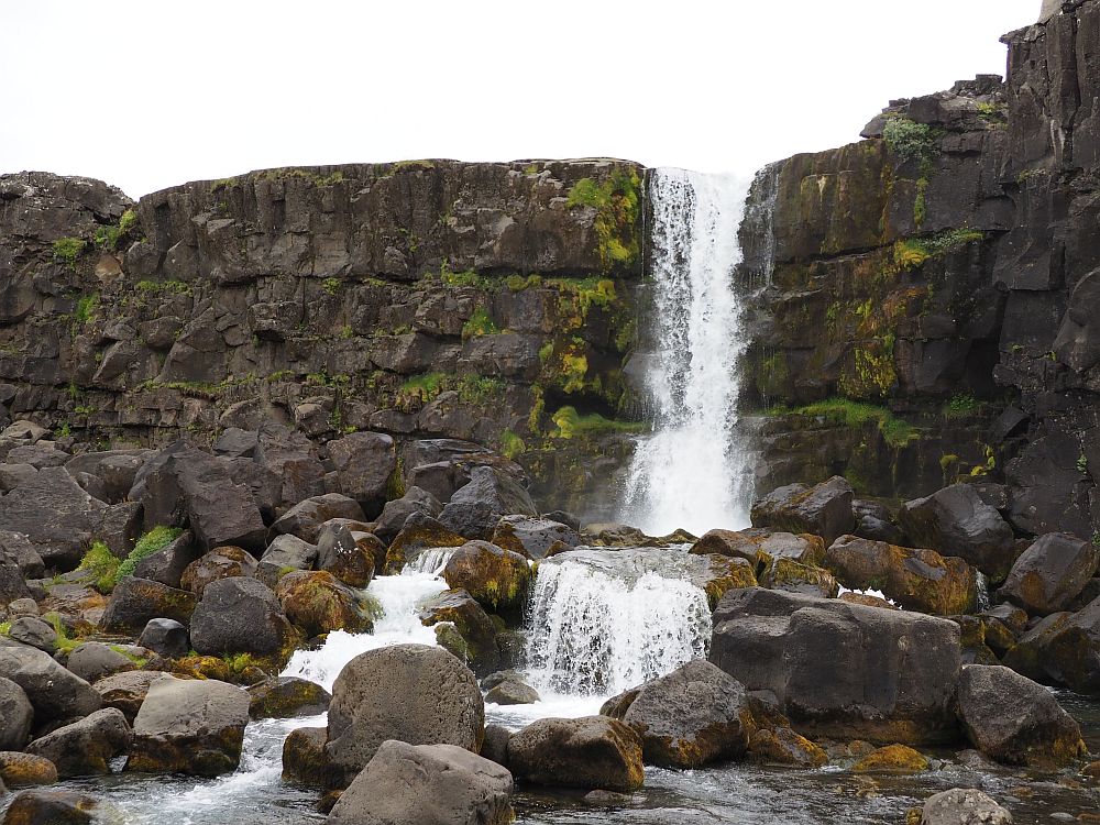
Öxarárfoss, by the way, is not entirely natural. Apparently the river Oxara may have been diverted back in the Middle Ages to provide water to the parliament that met there in Þingvellir.
Öxarárfoss in Þingvellir National Park: Route 1 from Reykjavik, then right onto route 36. Admission to the park is free, but there’s a parking fee. Pay onsite at a machine or online.
My favorite Iceland waterfalls
You’ll see on the map below that, if you don’t have much time, several of the waterfalls in Iceland are relatively near to Reykjavik, and could be seen in a day trip.
Iceland waterfalls near Reykjavik
Öxarárfoss is less than an hour from central Reykjavik, and Þingvellir National Park is certainly worth seeing.
Bruarfoss and Gullfoss are not on the ring road, but good paved roads lead to them. They could easily be combined into a single day trip. They’re both spectacular. If I had to choose, I’d have to say these were my favorite. If you have very little time, these are the ones you should see. Stop at Strokkur Geyser too, about halfway between Bruarfoss and Gullfoss, while you’re at it.
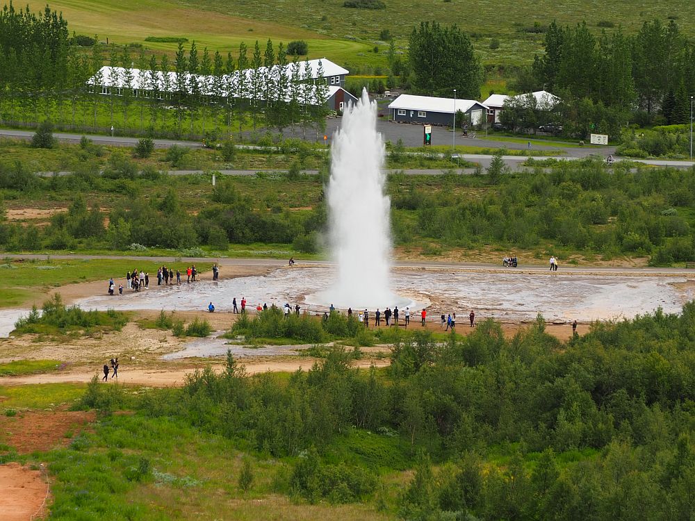
This tour from Reykjavik includes Thingvellir National Park (including Oxararfoss), Gullfoss and Strokkur geyser, plus a few other stops.
Gljufrabui and Seljalandsfoss are a bit more than an hour and a half from central Reykjavik. As waterfalls go, they’re impressive, but, in my view, less so than Gullfoss and Bruarfoss.
You could reach Skagafoss and Kvernufoss in about a two-hour drive. However, if you’re going to go all the way there, you really should stay long enough to check out Skogar Museum as well. That means it would be a long day, with all the driving. You could visit Gljufrabui and Seljalandsfoss as well on the way. It would be a more relaxed trip if you stayed the night near Skogar instead. Book accommodations in Skogar.
Dettifoss, Selfoss, Goðafoss and Kirkjufellsfoss are all too far for day trips from Reykjavik. Book accommodations near Dettifoss and Selfoss, Goðafoss, and/or Kirkjufellsfoss.
Which waterfalls in Iceland should you see?
My favorites? Bruarfoss is in first place, definitely. The color of the water and the shape of the waterfall makes it absolutely awe-inspiring. Gullfoss is a close second, I’d say, for its sheer power, and also its form. Dettifoss and Selfoss are a very close third and fourth: Dettifoss again for its power, and Selfoss because of its width, ranged along a cliff in such an unusual way.
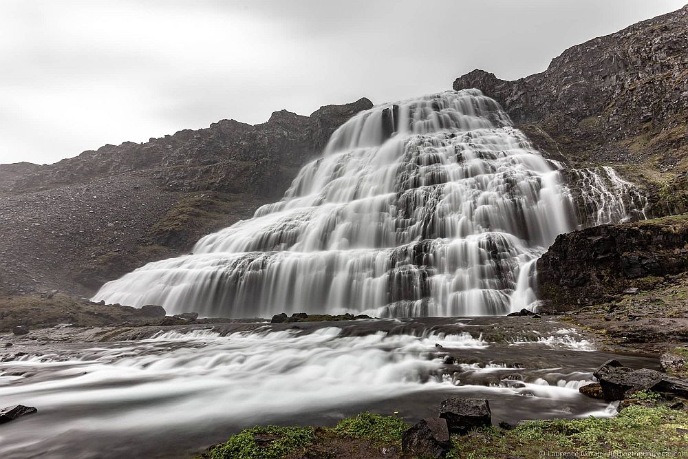
There are more waterfalls worth seeing, of course, but many of these were far enough off the ring road that we couldn’t have reached them in our two-wheel-drive car or we didn’t have the time. The one I regret missing is Dynjandi in the Westfjords. It looks absolutely breathtaking in the photos!
Iceland waterfalls map
I’ve marked all 12 Iceland waterfalls on the Google map below.
Video of waterfalls in Iceland
Have you traveled in Iceland and seen any waterfalls? Which was your favorite?
My travel recommendations
Planning travel
- Skyscanner is where I always start my flight searches.
- Booking.com is the company I use most for finding accommodations. If you prefer, Expedia offers more or less the same.
- Discover Cars offers an easy way to compare prices from all of the major car-rental companies in one place.
- Use Viator or GetYourGuide to find walking tours, day tours, airport pickups, city cards, tickets and whatever else you need at your destination.
- Bookmundi is great when you’re looking for a longer tour of a few days to a few weeks, private or with a group, pretty much anywhere in the world. Lots of different tour companies list their tours here, so you can comparison shop.
- GetTransfer is the place to book your airport-to-hotel transfers (and vice-versa). It’s so reassuring to have this all set up and paid for ahead of time, rather than having to make decisions after a long, tiring flight!
- Buy a GoCity Pass when you’re planning to do a lot of sightseeing on a city trip. It can save you a lot on admissions to museums and other attractions in big cities like New York and Amsterdam.
- Ferryhopper is a convenient way to book ferries ahead of time. They cover ferry bookings in 33 different countries at last count.
Other travel-related items
- It’s really awkward to have to rely on WIFI when you travel overseas. I’ve tried several e-sim cards, and GigSky’s e-sim was the one that was easiest to activate and use. You buy it through their app and activate it when you need it. Use the code RACHEL10 to get a 10% discount!
- Another option I just recently tried for the first time is a portable wifi modem by WifiCandy. It supports up to 8 devices and you just carry it along in your pocket or bag! If you’re traveling with a family or group, it might end up cheaper to use than an e-sim. Use the code RACHELSRUMINATIONS for a 10% discount.
- I’m a fan of SCOTTeVEST’s jackets and vests because when I wear one, I don’t have to carry a handbag. I feel like all my stuff is safer when I travel because it’s in inside pockets close to my body.
- I use ExpressVPN on my phone and laptop when I travel. It keeps me safe from hackers when I use public or hotel wifi.



I so want to go to Iceland, and it’s mostly to see all the waterfalls! I loved your post and photos. Some of those waterfalls have the most amazing turquoise water! I’ll keep this for future reference–hoping to make it to Iceland next year!
I hope we all can travel soon! Pandemic fatigue is real!
We are suckers for anything to do with waterfalls. The beauty and awe of nature is so grand when watching the rushing waters. It looks like Iceland is the perfect destination to see plenty of these natural wonders.
Definitely!
It’s tricky deciding a favourite waterfall but I’m choosing Gullfoss.
I would love to view it from above.
There were places I wished I had a drone, and this was one of them, but at many of these – and lots of other popular sights in Iceland – drones are not allowed.
Wow! When you said waterfall you meant WATERfall. Great photos and most helpful post for anyone visiting that country!
Haha, yes, serious waterfalls!